If you’re feeling energetic and a little bit adventurous, there’s no better walk in the Wentworth Falls area than the Vera and Hippocrene Falls loop. You’ll cover the best of the Wentworth Pass, the full Valley of the Waters Track and get to see two of the lesser visited waterfalls in the park.
As soon as you leave the popular trails things get rougher, but your reward is wild rainforest, waterfalls you’re almost guaranteed to get to yourself, swimming holes and a rarely visited view from the top of the falls which has real wow factor.
It’s a fabulous hike showcasing the best of the area, but you’ll need to work for it. There’s a lot of climbing and some sections of track which are indistinct. Here’s everything you need to know about visiting Vera and Hippocrene Falls.

The Vera and Hippocrene Falls Track
The stats
Distance: 10km circuit
Elevation gained: 660m
Difficulty: Hard
The Vera and Hippocrene track may not seem too far at just 10km, but the trail is very slow going and ends with a relatively steep climb.
Around half this hike follows what the national parks service describe as a ‘route’. This means little, and at times no signage and sections of rough track. You’ll encounter some steep and potentially slippery paths and plenty of fallen trees and debris. There is also quite a lot of climbing involved, even more than on the Perrys Lookdown Track (albeit marginally).
The optional side track to the top of Vera Falls, has eroded over time and has now become very narrow with a steep drop off to your left. It’s very short but definitely felt a little sketchy, we’ll go into more detail in the notes below.

Having said all of that - I am not the best on slippery tracks by any means and I did it - but I didn’t want anyone to encounter any unexpected challenges!
There are a few creek crossings required on this track, they would become impassable after floods, but otherwise will either be nothing notable or may require you to remove your boots.
You’ll see from the photos we visited after very heavy rain and only one crossing required us to go barefoot (and this was on the Valley of the Waters section of the loop).

Starting the trail: along the Grand Stairway
Although you could also start at the Conservation Hut, we’d recommend beginning at the Wentworth Falls picnic area. From here you follow the track for Wentworth Falls.
You’ll head downhill into the bush on a well maintained trail and come to a junction with Fletchers Lookout after 750m. It’s worth the one minute detour to see upper Wentworth Falls close up.


Once back on the main trail, you’ll cross the stepping stones over the top of the falls and continue descending along the Grand Stairway.
This is a magnificent part of the walk with incredible views of both the waterfall and valley. The path hugs the cliff edge and it’s incredibly dramatic.
The steps are steep and uneven but there is both a handrail and fixed cable, so there’s a lot of stability going down.

At the 1.7km mark you’ll reach the bottom of the upper falls and get some fabulous views of Wentworth Falls towering above you.
We visited on a really windy day so the waterfall was being blown sideways, but nonetheless it was still spectacular.


To the bottom of Wentworth Falls
As we already have a whole post on the route to the bottom of Wentworth Falls, I’ll keep this brief, but if you do want more detail, you’ll find it here.
The track heads very briefly uphill before skirting the cliff edges under multiple overhangs with yet more great views out to Wentworth Falls.

Roughly 350m after leaving the bottom of the upper falls you’ll arrive at a junction and now pick up signs for the Vera and Hippocrene route.
Next up is a very fun part of the descent known as the Slack Stairs. These are a series of steep staircases (or ladders), a couple of which are caged.


You need to go down backwards like on any other ladder and it’s not difficult unless you have vertigo.
A couple of hundred metres later you’ve descended significantly and you’re now just 350m from the bottom of Wentworth Falls.

After a couple of metal rungs, it’s all on a bush track which becomes rocky at the very end. If there’s been plenty of rain the bottom of Wentworth Falls is quite the sight.


Although a lot of people swim here, the water is brown every time we’ve seen it, but I’d recommend having swimmers with you in case you fancy it.
Plus there are other spots further along the trail too.

To Hippocrene Falls
From the bottom of the falls you head 10m down the track leading away from the falls and you’ll see the sign for Vera and Hippocrene Falls to your left.
This is where the route begins and it is significantly less maintained than the track to this point, although not immediately.


It’s also the last signpost you’ll see until you are beyond the bottom of Vera Falls. The first part of the route to Hippocrene Falls is actually on a great track.
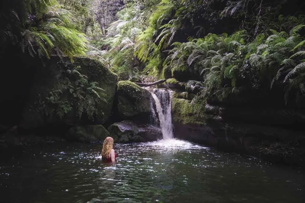
It’s in good condition and fairly flat. It’s also very easy to follow. The forest is gorgeous and you’ll be following the creek past cascade after cascade.

Some of them create wonderful little swimming holes that are sheltered from the current by giant boulders.

Roughly 700m after starting the route you’ll come to a junction. There’s red tape on the tree to guide you left. From here the track gets more challenging.
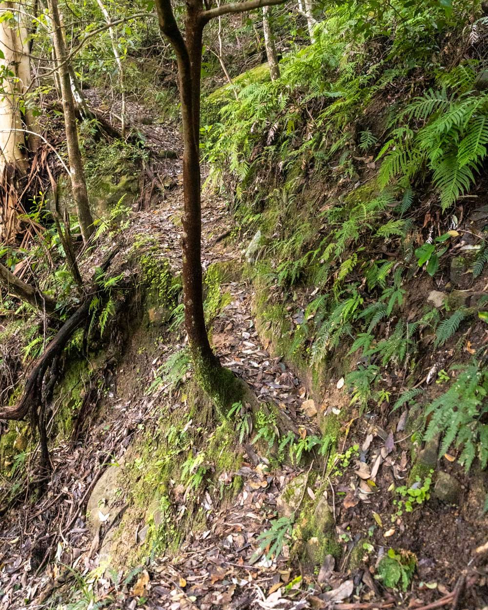
You’ll quickly come to a very narrow section of track (no exposure) before you reach a short but very steep descent on rocky track with some loose soil.


It’s probably only a few metres and some people won’t even note it, but as I am pretty bad with slippery downhills I didn’t like this bit! Still with careful footing it doesn’t take long to cover.

You’re then just 420m from Hippocrene Falls and the path is easy to follow for the most part and in reasonable condition again.
Note that there is always a track and if at any point you feel like you’re bush bashing you’ve strayed from it. There was one point where we had to stop and look carefully, but otherwise you shouldn’t have any trouble.
Arriving at Hippocrene Falls
The area in front of the falls is a bit of a mess. I don’t know if it will ever be cleared, but for now at least there is a huge amount of debris.

Luckily you can still get down to the base of the falls and follow the track to Vera Falls. The main track will not take you to the base, so when you get to the debris look for the little path down to the bottom.
There is a fallen log to climb over and some rocks to negotiate (slippery when wet) but it only takes a couple of minutes to reach the base.
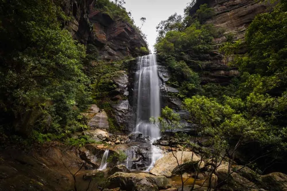
From here you get an uninterrupted view of the falls.

We visited after unprecedented rains and the falls were awe-inspiring. The sheer force of the water was incredible and the spray was so heavy that you could only look for a little time before needing to turn away and take a break!
Although this was an amazing sight it obviously meant the pool was not suitable for swimming. I’ve seen pictures where the waterfall is serene and the pool a lovely emerald colour, so there are pros and cons to all weather conditions!

If you are visiting when the flow is lower, the pool is very easy to access, there a just a few rocks to climb over and then you can get straight in.
Through the forest towards Vera Falls
It’s just 700m from Hippocrene Falls to the bottom of Vera Falls. From Hippocrene Falls continue following the obvious path until you come to a junction 180m later.
You need to turn right following the yellow tag. Roughly 50m later you’ll come to a creek crossing.


I expect this is normally very low, but even with some decent flow through it, the stepping stones were still above water and crossing was easy.

From here the path continues through the glorious mossy forest. It might be partly because we never saw another soul, but it feels wild in there!
After 70m you’ll reach some significant debris but you can pass through it without too much bother.


Beyond this the path became indistinct. At one point we lost it, but headed a few steps right and picked it up again.
If you aren’t on a distinct track you’ll probably have headed a little to the left of where you need to be, so scout around and you’ll find it. After following a flat trail through the forest it begins ascending beside the creek.

Approximately 350m after crossing the creek you’ll arrive at a junction, which is beside a hollow tree. To get to the bottom of the falls you need to head left (the path heading uphill is the main track which you’ll take after the detour to Vera Falls).
To the bottom of Vera Falls
From the junction to the base of the falls is just 120m. At first it’s an easy and gentle descent along an obvious dirt track.
You’ll then arrive at a creek and see a red ribbon tied to a tree directly ahead of you, you’ll also hear the falls. From here it’s easiest to go right and follow the indistinct track.

It feels counterintuitive because the falls are to the left, but it’s a better route as there are less branches to sidle between and rocks to climb over.
On the way I went straight and getting through the branches was a pain, the route to the right was plain sailing. After just a few minutes you’ll reach the bottom of the falls.

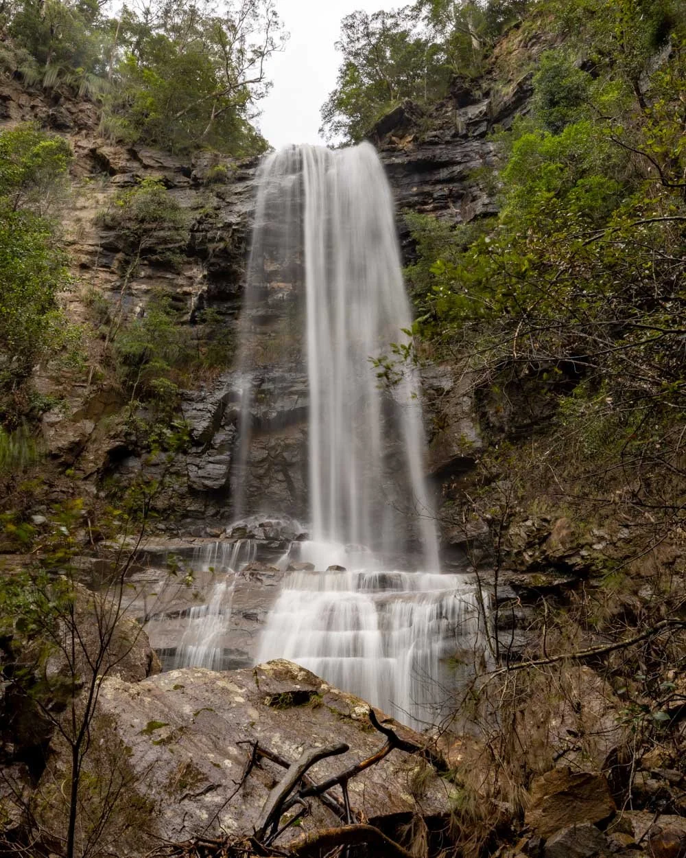
At the moment there is significant debris in front of the falls. If water levels were lower we’d have simply walked in front of the debris to get a clear view, unfortunately it was too deep on our visit.
Even so we still got a good view of the falls, which are really something. In times of lower flow you could walk closer which would no doubt be even better.

I feel like these falls would be so much more well known if they weren’t surrounded by so many other waterfalls in the Valley of the Waters which are easier to reach.
In some ways that makes it even more special though as you get to see one of the lesser visited falls in the area.
To the top of Vera Falls
From the bottom of the falls you need to head back to the junction with the hollow tree, you are now 5km into the walk but it feels longer!
From here take the path heading uphill. It’s steep but not slippery and had some beautiful orange coral fungi on our visit.


You’ll quickly come to a junction and a signpost saying ‘way out’. From here you can take a short detour to the top of Vera Falls.
We had a watch malfunction here, but we estimate it to be roughly a 200m detour each way (we fixed the watch issue back at the junction so the rest of the stats are fine!).

The top of the falls are utterly fabulous, but unfortunately a short stretch of the track to reach them is a bit sketchy. Erosion has caused it to narrow and you are walking beside a big drop.
There is little in the way of suitable handholds either - don’t trust the branches as they easily snap! The narrowest bit is really only around four steps long, but take extra care here and if in doubt skip it.
Once you’ve passed the flat narrow section you have a very short descent, which has one steepish part before you arrive at the top of the falls.

Exploring the top of the falls
The view from the top of the falls is jaw-dropping. I had never seen pictures of it and I can’t believe it’s not more well known!
The mountain view is just spectacular and the flow of the creek into the waterfall makes it an exhilarating spot. Needless to say it’s an unfenced cliff edge and you never want to go near the edge.
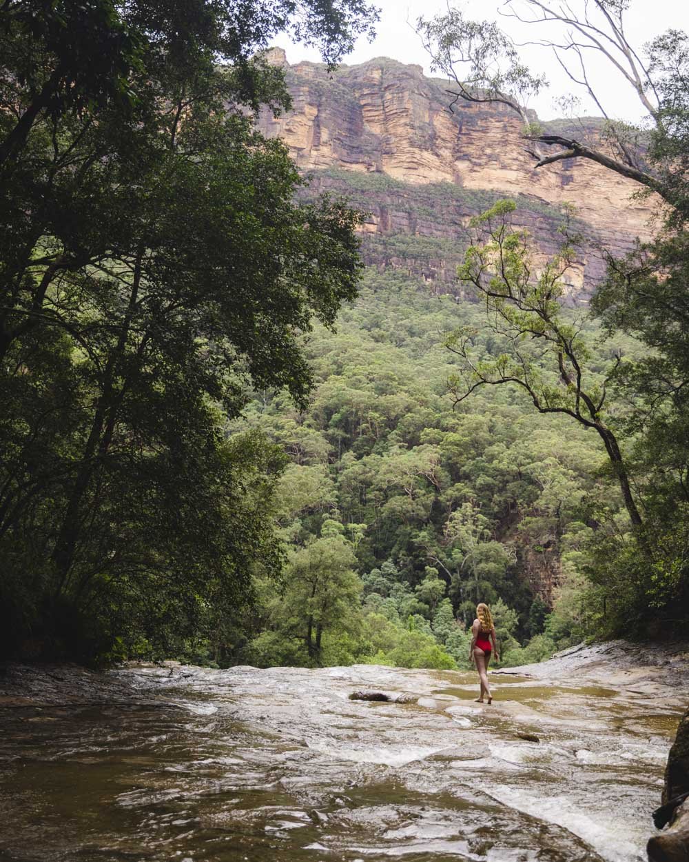
Even in times of high flow there’s a good dry patch to take some photos at. You then want to walk back up the trail for a few seconds and take the path on the left (just a few seconds long) to get to the area a little further back from the falls.
This stops you having to walk through the water which has a potential slip risk.
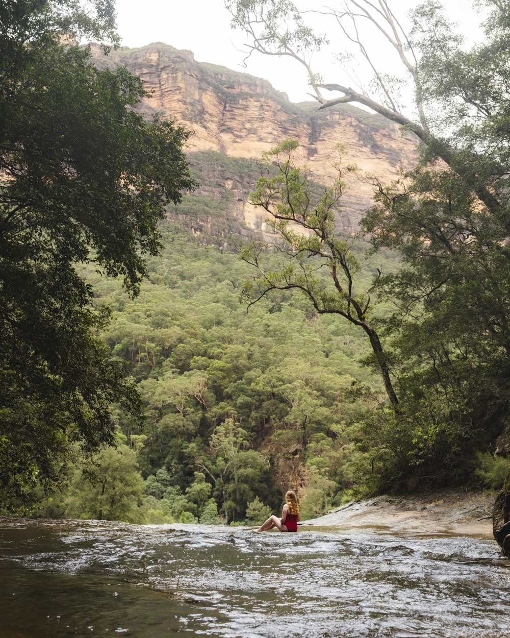
The side track gets you to another dry area and even a tiny little beach. I couldn’t believe how wonderful it all was, there’s even a cascade with a shallow pool to take a dip in.
Everything about it is stunning, with wild jungle vibes.

However, you do need to exercise caution when the creek is in high flow like it was for us. Despite how some of the photos look (clever camera angles) I was never anywhere near the edge of the falls.
I stood on dry rock far back from the edge and crossed the creek close to the cascade and far from the main flow.

Sorry for stating the obvious and I feel like anyone taking on this walk would know all of this, but just in case! However, with care, exploring this area was one of my favourite parts of the whole trail.

Heading to the Valley of the Waters
From the top of the falls head back to the junction and follow the way out sign. It heads uphill on sloping switchbacks through a sensational rainforest.
At times the path is narrow and there are a few very short eroded sections that are close to a drop on your left.
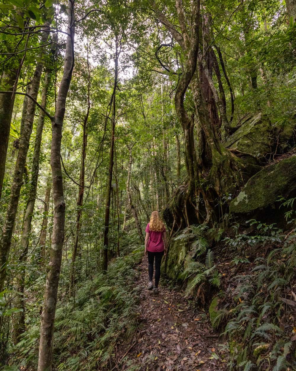
It’s not like the bit to the top of the falls but I did watch my footing a few times. It’s very easy to follow though and so atmospheric.
After 400m you’ll come to another small waterfall surrounded by mossy walls which was very pretty. You’ll see another way out sign to the left.


This marks the trickiest creek crossing of the walk. You have to cross using the two large boulders which does require a leg stretch.
It’s actually not hard if you trust you won’t slip which is something I struggle with!

Once you're across, the tree root covered track continues uphill and passes yet another way out sign. This next section is steep and following rain, muddy.
Strangely though despite this it wasn’t slippery, although I was happy to be ascending and not descending.
There’s a fallen tree but it’s easy to climb over. After 500m you’ll see a path on your left which is marked as Roberts Pass, this is an alternative exit route which we’ve yet to take but is on our list!


Almost immediately beyond this junction you’ll cross a landslide area. It’s flat and at on our visit, stable and easy to pass through.
The track continues through lush dense forest and passes a couple of fallen boulders before you arrive at a junction with the Wentworth Pass (300m beyond the junction with Roberts Pass).
From here you follow signs for the Conservation Hut.

The Valley of the Waters
From the junction you are now just under 3km from the end of the walk. Although the walk is still relentlessly uphill you are now on much better maintained tracks so the going is much easier.
Initially you’ll be on the slightly rougher Wentworth Pass before meeting the exceptionally well manicured Valley of the Waters Track.
This part of the walk is sublime, and no matter how many times I’ve done it, it never loses the wow factor.

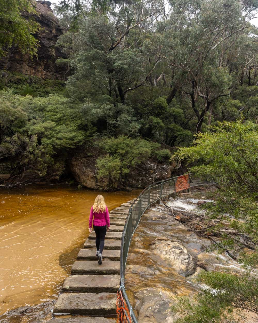
As you climb you’ll pass a couple of beautiful falls before you reach the last significant creek crossing (ie one that doesn’t have official stepping stones).
I’ve crossed this many times using the rocks without issue, this time it was a boots off situation, but as long as you’re prepared for that (post heavy rain only) it’s not a hard crossing.
You’ll then ascend the last tiny bit of Wentworth Pass before reaching Lodore Falls and the Valley of the Waters Track, details of which are in this post.
The abbreviated version is that you’ll climb up well maintained staircases past glorious waterfall after glorious waterfall, culminating in the canonyers favourite, Empress Falls.
After this it’s into the bush as you continue ascending.

Just after the second lookout you’ll pass a junction with the Overcliff Track, if you’re still feeling spritely you could take this longer and much prettier route back. We were not feeling spritely and continued along the track towards the Conservation Hut before taking the Short Cut Track.
At the junction with the Short Cut Track you’ll see the Conservation Hut, one staircase away from you - a great place to head for a drink before finishing the walk (sadly it’s currently closed but hopefully it will re-open soon).


The Short Cut Track is just under 1km long and an easy end to the walk. The climbing is over and it’s all either flat or downhill. If you’re lucky you might even spot a lyrebird which is the perfect end to a really incredible walk.
Getting to the Vera and Hippocrene Falls Track
The walk begins at the Wentworth Falls Picnic Area which can get very busy on weekends. Parking is free and unlimited but can be hard to come by. If you can’t find a space, the nearby streets also offer free and unlimited parking. You could also begin this walk at the Conservation Hut but parking there is even more scarce!
If you don’t have a car you can catch the train to Wentworth Falls Train Station but it does add on about 30 minutes additional walking.
This post may contain affiliate links, meaning at no additional cost to you, that we will earn a small commission if you click through and decide to make a purchase. This helps towards the costs of running our website. Thanks for your support!