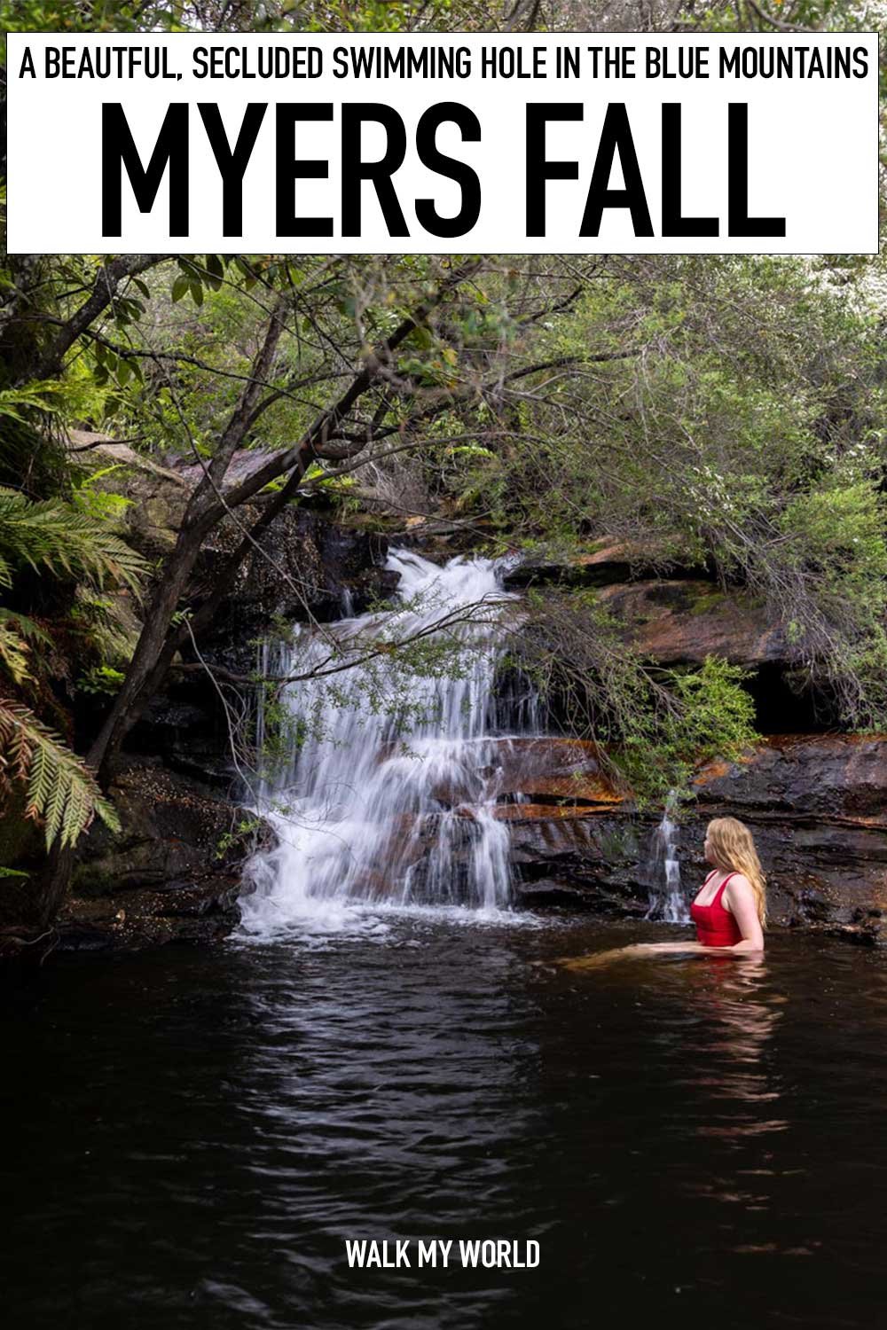
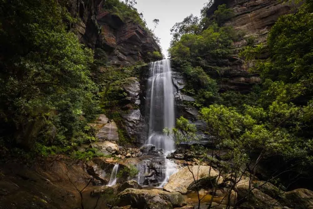
Myers Fall is a pretty little cascade tucked away off a long forgotten walking trail in Katoomba. The falls flow into a small but picturesque plunge pool and are about as secluded as you can get considering it’s quite a short walk.
However, this spot won’t be for everyone, the walk is not long, but involves a steep climb and a short stretch of rough track to reach. If you love to explore every nook and cranny of the Blue Mountains and it doesn’t have to be a show stopper for you to want to see it, then read on. If you’re simply looking for a spectacular swimming spot, then read this post instead.
Here’s how to find Myers Fall and what to expect when you do.

The walk to Myers Fall
The stats
Distance: 3.1km return
Elevation gain: 140m
Difficulty: Moderate, but with a 100m rough stretch
Summary: The walk to Myers Fall has a steep hill which is partially made up of loose stones. On the way down, 150m of this is very slippery and requires care. The rest of the walk is on a decent track but for the last 100m which are rough.
I would not recommend doing it in wet weather when a few sections would become very slippery and unstable. The 100m of rough track is overgrown and scratchy in parts, with one bit where you need to climb down a grassy hill. It’s only around three steps but steep and eroded, in wet weather it would be a real slip risk.

Starting the walk: along the fire trail
There are two possible start points to reach Myers Fall, one is suitable for any car, but is roughly 1.2km (return) longer and one requires some clearance, or an appetite for a bit of risk to the underside of your car. We'll go into more details on where to park and what the road is like at the bottom of the post.

Our notes will begin from the shortest route to get there, but we’ll outline the longer route from the Minnehaha Falls car park later in the post for those that don’t want to tackle the dirt road.
From the parking area you head around the side of the gate and onto the fire trail. The trail is well maintained and flat, taking you on a sandy path between the gum trees.

After 250m you need to head right at the junction, following signs for Katoomba Creek. The trail follows the power lines, but it’s nice enough for a fire trail. The path is either flat or ever so slightly downhill.
After 720m take the right fork and after a further 180m (900m into the trail) you will see a sign for Bruce’s Walk (we’ve walked half of Bruce’s Walk before, but not this section).

Descending the steep hill
At the sign for Bruce’s Walk you need to turn right. Down the massive hill. This is still a fire trail, but it’s steep and has plenty of loose stones. If you’re like me and don’t like descending on loose stones, the first 150m are unpleasant, with the first 50m being the steepest.

The stones act like scree and I found it easiest to turn sideways and move slowly. I know some people love this kind of terrain and run down it, but personally I hate it so was glad when it was over!
After this point you will continue descending, though less steeply and the path is not slippery (when dry).

It’s a mix of gravel track and then grassy path, which is worn in parts but easy to walk on. The total distance of the hill is 600m, with just that first 150m being slippery, but all of it being somewhat steep.
At the bottom of the hill, you’ll see a shallow creek on the trail which you can cross easily.

After crossing this creek, it’s just 50m until you need to make the turn off Bruce’s Walk and head downstream at the next creek.
The last 100m (off track)
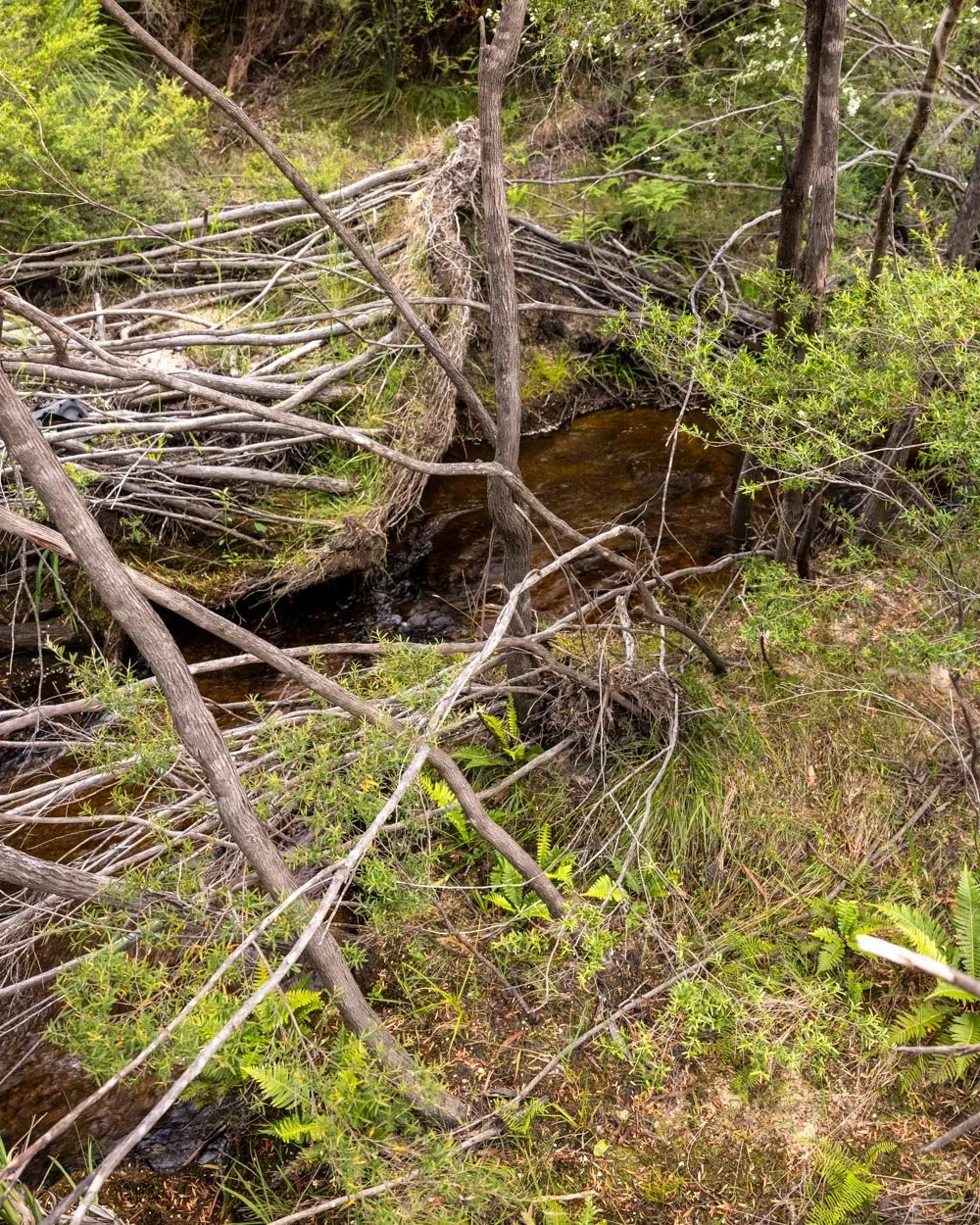
So this is where the fun/bush bashing begins. At this point the obvious trail disappears and you have to follow what is a really overgrown semi-trail. It is hard to show you what it looks like in photos as the trail is essentially overgrown bush!
At the 1.55km mark or 50m after the path flattens you need to turn left at the bigger creek. There is a worn path which is flat and the creek will be on your right.
Follow this path for a couple of minutes and you will reach a tiny creek crossing (you won’t see it until you’re almost on top of it as it’s overgrown).
This is jumpable for most people, but we built a little log bridge from fallen branches to help me cross as knowing my jumping ability I would have landed straight in the mud (it’s not much of a water crossing, more of a mud crossing).
From here continue with the creek on your right for approximately 10m and then look for the crossing on the right. There are many fallen branches and it’s easy to step over the creek, the creek will now be on your left.
From here follow the overgrown path, which is scratchy in places, and look for the rock platform on the left. Cross on to it when you can as it’s a bit easier, even if it doesn’t last long. You’ll have to leave the rock platform after a few steps but can join another one a touch further down (you’ll see and hear the top of the falls here).

Where you can, don’t go up the hill, as sometimes there looks like a worn trail that leads to some unstable gullies. Try and keep close to the creek where possible. and use the rock platform by the creek when you can.

You will encounter overgrown bushes and some long grass. The long grass hides that there are some little gullies so your foot may sink lower than you expect - take it slowly and it’s fine as it’s stable enough, just unexpectedly deeper than you’d think from looking at it.
There are branches and trees down too, but none are difficult to cross over.
The last few steps require climbing down a grassy slope with uneven worn footholds. This is unstable and narrow and not advisable when wet. However, once you’ve come down these couple of little ledges you will be on a narrow grassy verge beside the pool.

Swimming at Myers Fall
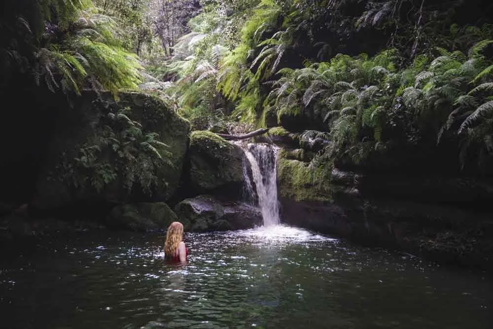
Normally I would say to access the pool from the far end of it, where you could just walk straight off the grassy area into the water. However, there is a lot of debris and downed trees in that part of the pool. For this reason I personally found it easier to go in inbetween the two trees just before the final branch across the pool (which you can scoot under with ease as it’s thin and above the water).
You will head straight into deep water, but it’s easy enough to get back out because there is a stable tree to help pull yourself up, as well as a solid bit of riverbank to get your foot on to.

Although the pool is actually a decent size, due to the downed trees the swimmable portion is now quite small. However, the waterfall is very pretty and the cliff wall, trees and ferns almost entirely shelter the pool from the outside world. You almost have to be sitting down to even see it! This gives you the feeling of being hidden away in your own little secret spot.

The water is cool but not freezing and the pool is deep (in the middle). The rocks beside the falls mean you can sit right beside the cascade which is always fun.
It’s a lovely spot which is definitely added to by the fact you feel so secluded, but as mentioned in the intro, this is for people who explore the mountains a lot and want to see every inch of it, not for an occasional visitor who wants to see the most spectacular waterfalls and swimming holes.
When you’re ready to leave the falls, the walk back is in some ways easier. Though you do have to go uphill, everything feels more stable in that direction.


Keep them wild
Please remember to take all rubbish with you and keep these places wild and pristine - as with anywhere in the outdoors. It’s important to leave them exactly as you found them so they will remain beautiful for generations to come.
Litter tends to breed litter, so if you do spot any and are able to pick it up and dispose of it outside the national park, it will go a long way to keeping the area clean.
There are no facilities at the parking area or anywhere along the trail for Myers Fall.
Where to park for Myers Fall
If you have a car that can be taken on a dirt road (fire trail) with some lumps, bumps and ruts then you can park where we did at these coordinates: -33.6859174, 150.3323147 (in Katoomba).
The fire trail portion of the drive is roughly 1.3km. Some of it is in great condition and some a bit bumpy. In dry times it’s not a 4WD track, but it would be more comfortable in a car with a little clearance. I know lots of people happily drive small cars over lumpy sections of track, others would find it thoroughly unenjoyable.
To find the parking area at the above coordinates you need to make sure you go via Tenth Avenue, finishing along the dirt road between Eleventh and Twelfth Avenue.
However, if you don’t have a car you want to take off the sealed road you can park at Minnehaha Reserve. This will add on an additional 1.2km (roughly) to the walk. This will be predominantly uphill on the way. It’s on a fire trail and conditions looked fine, but we only eyeballed it and did not walk it ourselves. It’s worth noting that Minnehaha Falls is on council land and is therefore a dog friendly track, however the route to Myers Fall heads into the Blue Mountains National Park where dogs are not allowed.
This post may contain affiliate links, meaning at no additional cost to you, that we will earn a small commission if you click through and decide to make a purchase. This helps towards the costs of running our website. Thanks for your support.