When you fancy a day at the beach, but you don’t want to face the crowds, head to Erskine Creek. The picturesque creek has clear green water and a huge beach, perfect for lazing around on. You’ll be surrounded by dense forest and a tall sandstone cliff which makes you feel tiny as you swim by.
The walk to get there - along the Jack Evans Track - is surprisingly easy. The track is well maintained and never very steep, which is a rarity for gorge walks in NSW. There’s another route down to a different part of the gorge, which is more challenging and on our list for next time. The trail in this post is your easiest route down to the creek.
Here’s everything you need to know about the Jack Evans Track.

The Jack Evans Track
The stats
Distance: 2.7km return (plus 1.2km return for Nepean Lookout)
Elevation gain: 205m
Difficulty: Easy - moderate
This route down to the creek is all on a well maintained path. Whilst there is a bit of a climb on the way back up, it’s on good terrain and never overly steep.
There is some rock hopping to be done at the end of the formed track if you want to make your way over to the sandy beach without getting wet.
If you don’t mind which side of the water you keep your things on, then you can just swim over instead and avoid the rock hopping.

A quick detour to an amazing lookout
The trail begins from the same car park as the Nepean Lookout Track. If you have time, we’d recommend going to check out the lookout before heading down to the gorge.
The lookout is 600m from the car park, but it’s mainly flat or gently downhill on a well maintained fire trail.
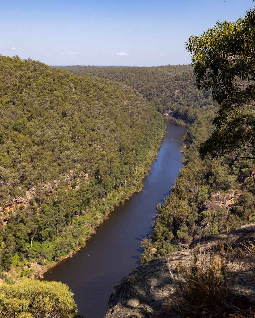
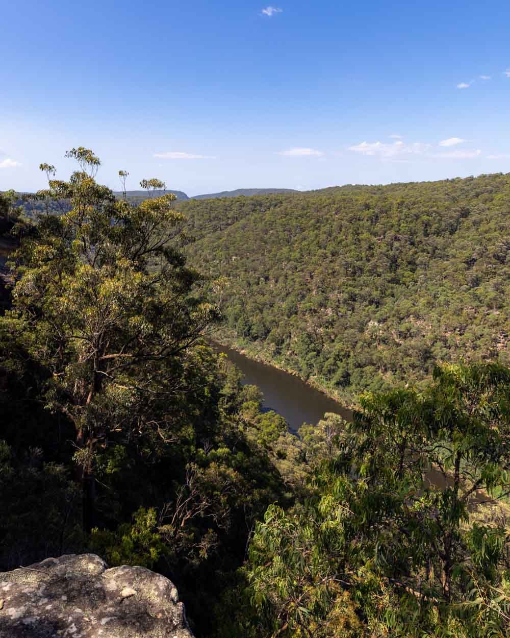
It’s a large unfenced cliff edge and feels very dramatic, offering a spectacular view over the Nepean River and Fairlight Gorge.
Once you return to the car park, the Jack Evans Track begins by the information board. Don’t be alarmed when you see that the sign indicates it will take you four hours!
Given we only had 3.5 hours until the main gate would be locked when we started, I was a bit taken aback as this was much longer than I was expecting.
The sign must relate to a different version of the track which is now closed, because it took us less than 20 minutes to reach the creek!
The descent begins
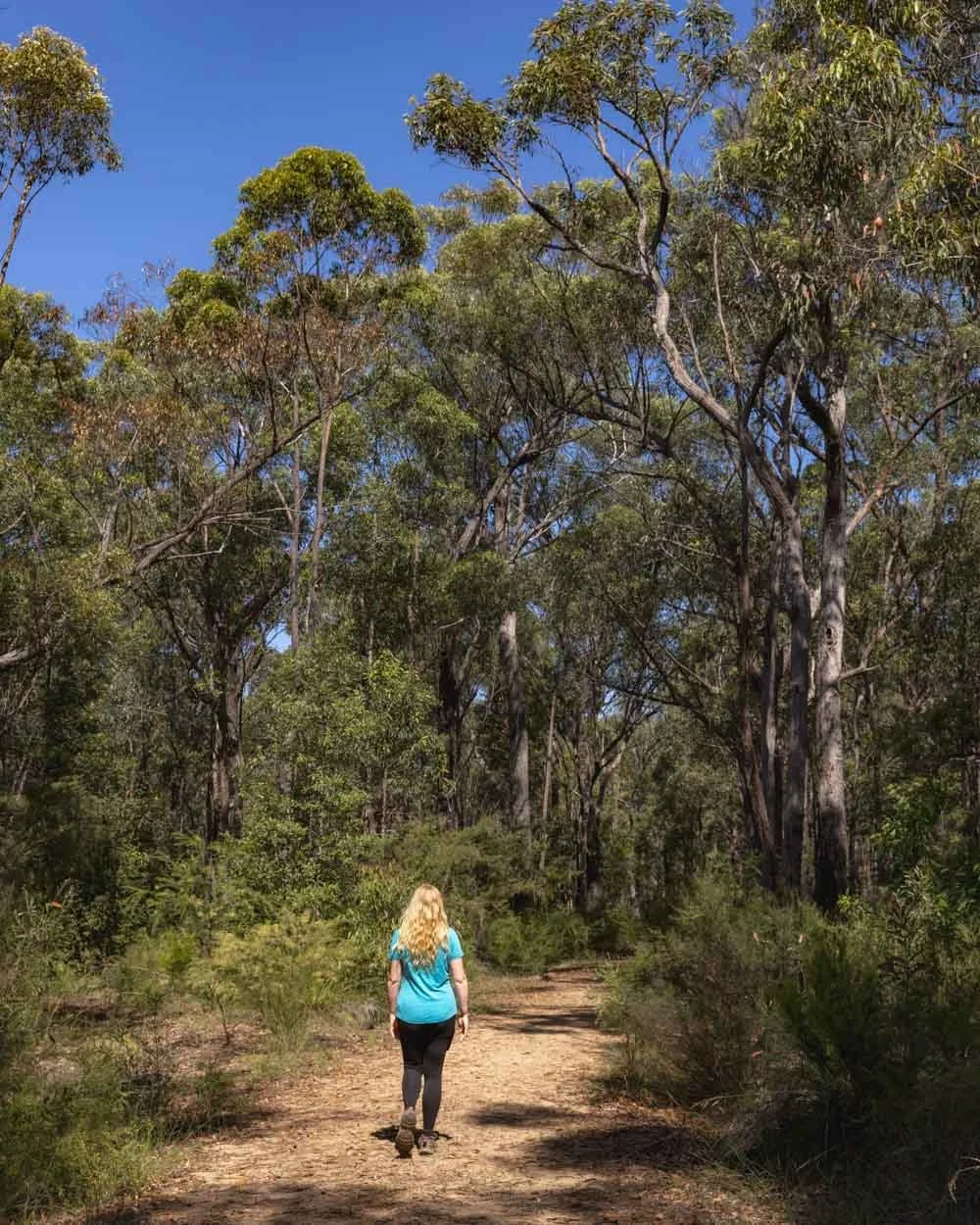
The path begins heading straight into the bush and was lovely and shady in the late afternoon, which was perfect as it was still 30C!
The trail begins descending almost immediately, but not steeply. In fact, it’s so leisurely that we were wondering if the end of the track would be a mass of staircases - happily it isn’t!

The path can be a little rocky in places, but it’s mainly a good dirt track with the odd few well maintained steps thrown in.
On the first half of the walk there is some leaf litter along the trail, I didn’t find it slippery when dry, but it might be when wet.

After 300m you’ll see an opening on your right and from here you’ll get your first glimpse down into the creek.

Heading to the creek
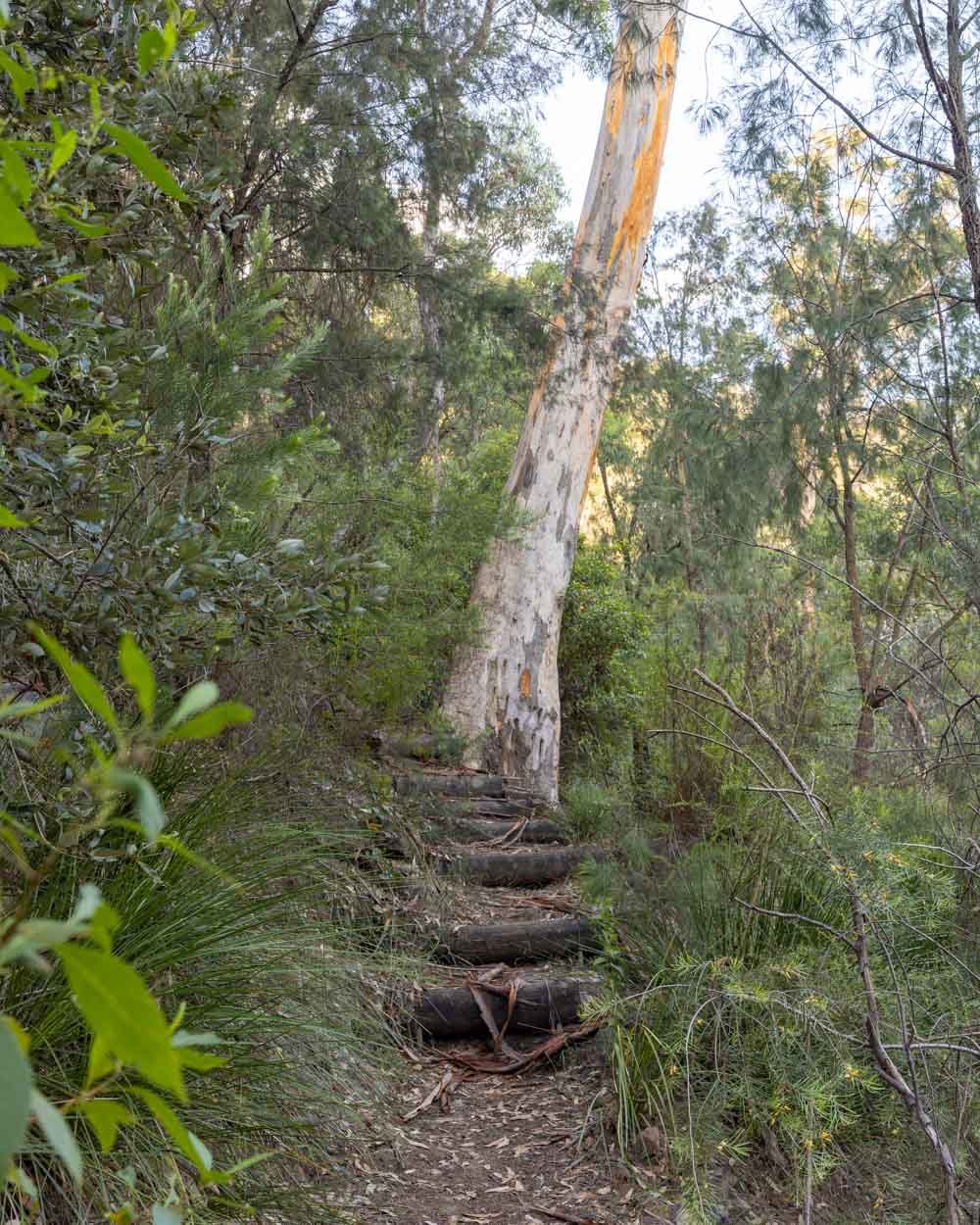
After another 150m, the path gets a little steeper, but the stairs make it easy. You’ll pass some pretty rock formations and head into denser bushland.
Roughly 850m into the walk you’ll hit a narrow dirt path which zig zags downhill very gently.

At points it is entirely flat, or feels that way at any rate! The forest is very pretty and it’s hard to believe that such an easy path will soon pop out right at the water’s edge.
At this point we were still waiting for the steep descent that never came!


After 1.2km from the start of the trail you will see the creek ahead of you and you are basically at the water’s edge. From here the path is unmaintained.
Turn left and follow the track along the water. It’s mainly rock hopping at this point, not difficult, but much slower going.


Less than two minutes into this section you will start to see large rocks leading down into unobstructed parts of the water (before this the water has too much debris to enter comfortably).
From here, if you don’t mind not having your things on the beach, or you have a good dry bag, you can just get straight into the water and avoid any further rock hopping.
This option meant that it only took me 20 minutes to get from the car park to swimming, which goes to show how good the track is.
Heading to the beach
If you do want to keep dry and get round to the beach, you have about 170m of rough track to go. You keep heading straight until you see the small rapids.
This is about 100m from when you first reach the water’s edge. From here there is some debris to negotiate and then you will reach a few large rocks sticking up out the water and can cross over to the boulders on the other side, which is roughly 70m away.


It’s likely you’ll have to remove your boots here, but it’s still less than knee deep.
You can then make your way along the edge of the riverbank to the sandy beach. Personally I swam it, which only takes one minute and is definitely the easiest option. Joe took the dry route which takes a little longer, but still only around five minutes.
Swimming at Erskine Creek
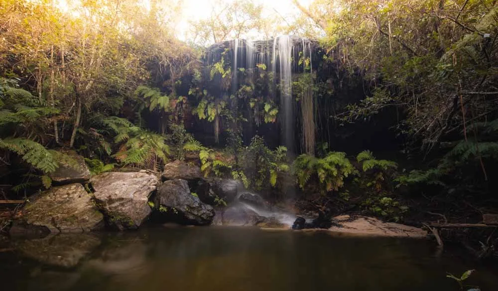
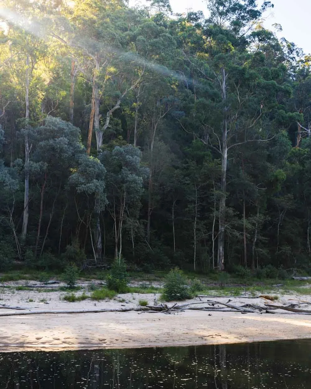
When you reach the beach and can properly take in your surroundings, you’ll see you’re sitting at the bottom of a beautiful gorge.
You’re surrounded by thousands of trees and a particularly striking orange cliff which reminded me of nearby Glenbrook Gorge.

It’s the sort of spot where you feel dwarfed by nature in the best possible way. It’s a wonderful place to sit back and relax.
The water in the creek is actually really shallow for quite a way from the sand, but then it does get deep nearer the middle and is great for swimming.


Due to the shallow nature of a large part of the water, it’s the kind of place that probably won’t be good to visit after a long dry spell.
Given we visited in a La Nina year, the water level was perfect and I could go for a long leisurely swim right the way through the middle of the creek.

Until you near the rapids on one side and the boulders on the other, there is very little in the way of rocks in the water so it was really relaxing.
The bottom of the creek is sandy, but there is some leaf litter and mud, so it’s nice to have the beach to sit on.


The only other thing to note is that somewhere along the way I did seem to get some black marks on my swimsuit.
They came out ok in the wash, but it might be somewhere you want to avoid wearing white just in case!
The walk back up
The walk back up is easier than you’d think given that you’re starting at the bottom of the gorge. The good terrain really helps, as well as the fact it’s never overly steep.
From the rapids it took Joe just over 25 minutes to get to the top, and it’s even less if you swum across and avoided the rock hopping.
It will be harder if you’re walking on a really hot day, but there are lots of rocks to sit on and take a break if needed.
Facilities at Erskine Creek
There are no facilities at all at the creek or the car park. Please take all rubbish with you and keep the area pristine. As you drive into the national park you will pass a toilet block just near the car park for Jellybean Pool.
Getting to the Jack Evans Track
The Jack Evans Track is located in Glenbrook in the Blue Mountains National Park. It is located off the Oaks Fire Trail which is unsealed.
From the end of the sealed road it takes around 15 minutes along the gravel road. At time of writing the gravel road is in good condition and suitable for any vehicles, but it could change after heavy rain, so if in doubt give the parks service a call ahead of time.
You will have to cross the causeway to get to the Oaks Fire Trail which can flood after heavy rain, it’s best to check the national parks website to make sure there are no alerts for the area before visiting.
This post may contain affiliate links, meaning at no additional cost to you, that we will earn a small commission if you click through and decide to make a purchase. This helps towards the costs of running our website. Thanks for your support.