If you’re scared of heights then don’t look down! The thin wires of the Bowtells Swing Bridge do nothing to hide the fact that you’re suspended many metres above the raging Coxs River. Added to that, the bridge sways with every step and jangles the most as you hit the middle.
There’s no reaching for a reassuring hand because it’s strictly one person at a time! For some crossing will be a nail biting affair, but for others it will be one of the most fun experiences you can have in the mountains!
Personally I love swing bridges and after finding some epic ones in New Zealand recently, heading out to Bowtells was a must do on our return.
Here’s everything you need to know about visiting the Bowtells Swing Bridge.
The Bowtells Swing Bridge
The different ways of getting there
Most people visit the bridge when walking the 45km multi day Six Foot Track, but there are two additional ways of accessing it which are easy day walks.
The first is the option we took, which is a 12.6km return walk. The second is a much shorter walk at just over 2km, but it involves a long drive on a gravel road (the longer walk starts from a sealed road). The shorter walk begins at the Coxs River Campground and is easy.
We haven’t done this walk yet, but if you’re planning this route and want to know more about the bridge, rather than the longer trail, just skip through to the end of this post.
The Megalong Road to Bowtells Swing Bridge Walk
The stats
Distance: 12.6 km return
Elevation: 466m
Difficulty: Easy - moderate
The walk to the swing bridge is all on well formed track. It’s eroded in parts, but not along any sections which would make it precarious.
There are some climbs - mainly on the way back - but it’s never overly steep. There are a few minor creek crossings which ordinarily you barely notice, but can become impassable if in flood.

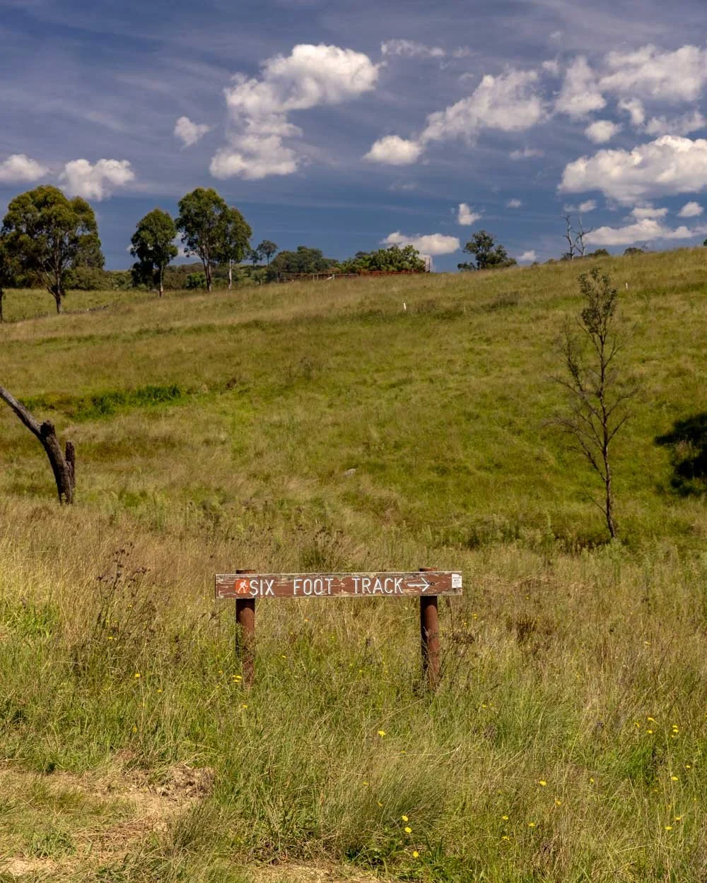
Starting the trail at Megalong Cemetery
The first 850m of the track are on a gravel road. I was not looking forward to this section, but in honesty the scenery is beautiful, it’s all rolling farmland scattered with boulders and lots of birdlife. Definitely not a hardship.


We were lucky and only one car passed us so we didn’t have any issues with dust being kicked up, which would make this otherwise pleasant road unappealing.
The road descends at first and then ascends before you’ll see a signpost for the Six Foot Track on your right. From here it’s a proper trail all the way and well marked.
Through the farmland
You’ll cross over a little bridge and then begin heading uphill across farmland. It’s very exposed along this section which you definitely feel on a hot day.

The narrow path is heavily eroded but as you’re just crossing farmland, it’s not too much of an issue. It is likely not so great if you’re carrying a big pack for the Six Foot Track though!
It’s a pretty stretch of trail with beautiful views over the rolling vineyard of the Dry Ridge Estate.


On the way back when you walk this stretch, it goes from pretty to spectacular as you’ll be walking straight towards the mountains which look simply sensational.

There are several stiles to climb as you make your way uphill, before you begin descending to the creek (2.3km into the track). You’ll cross the little creek and enter bushland for some much needed shade.
Into the bush
Although there are some undulations, once you enter the bush a lot of the track is flat, which makes for pleasant and easy walking.
If you’re not visiting on a busy weekend you’ll probably need to clear your fair share of webs, which crisscross the track with alarming frequency.

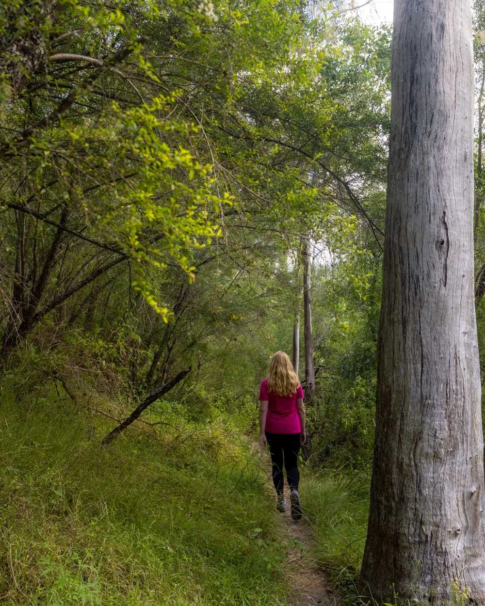
Otherwise it’s a nice piece of bushland and the terrain is good, making for a relaxing stroll.
You’ll pass a little bench seat at the 3.3km mark if you want a break, and a kilometre of leisurely walking later you’ll begin the descent.

It’s mainly on steps which make it straightforward and you’ll quickly come to a gorgeous little cascade with crystal clear water.
This is a lovely spot to dip your feet and it sits beside a huge boulder which keeps it very cool and shady.

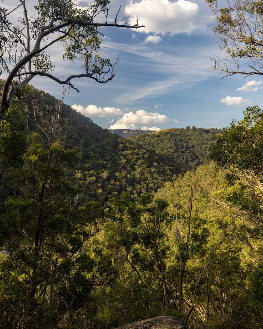
Descending to the Bowtells Suspension Bridge
Although you are descending through the forest for much of the time, there is also plenty of flat track to break it up, so it doesn’t feel difficult in any way.
You’ll be walking above the river and depending on the water levels, the sound can be quite something. For us it sounded like we were going to arrive at some pretty major waterfalls due to how many cascades had formed around the rocks.

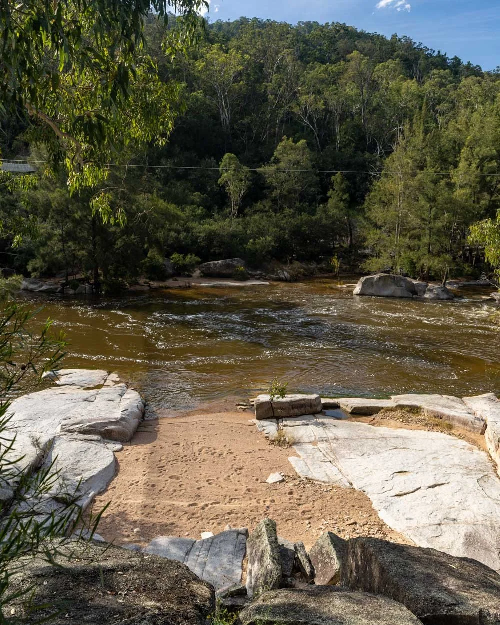
As you get closer to the river you’ll see lots of social trails leading down towards it at various points. It was hard to tell how nice these spots would normally be as the river was brown and murky on our visit.

To be honest it looked like the little beach by the bridge would be a nicer place to have a dip, but it could be quite different in drier times.
Roughly 6.2km into the walk you will see a signpost pointing you right, towards the bridge, which is just 100m away.
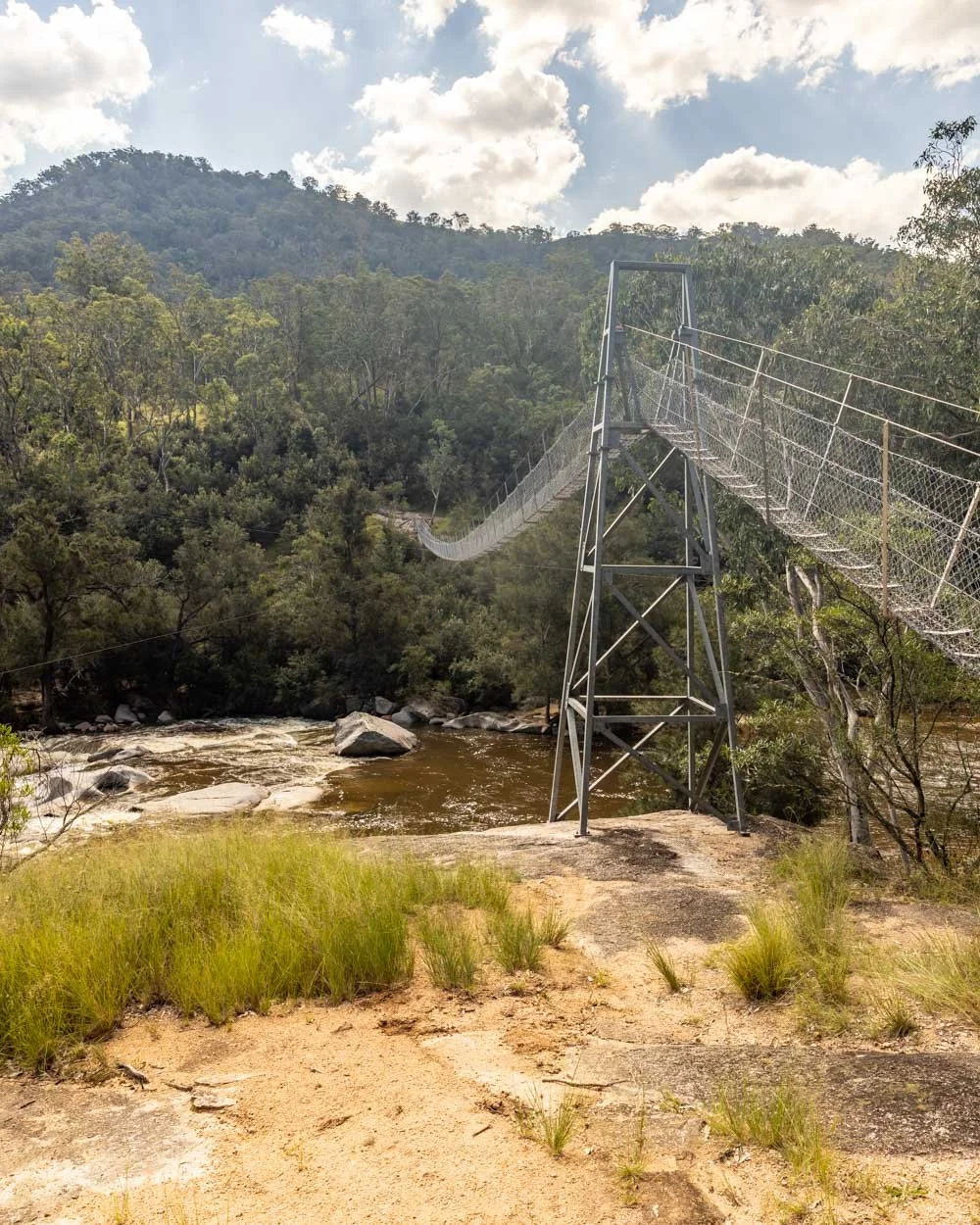
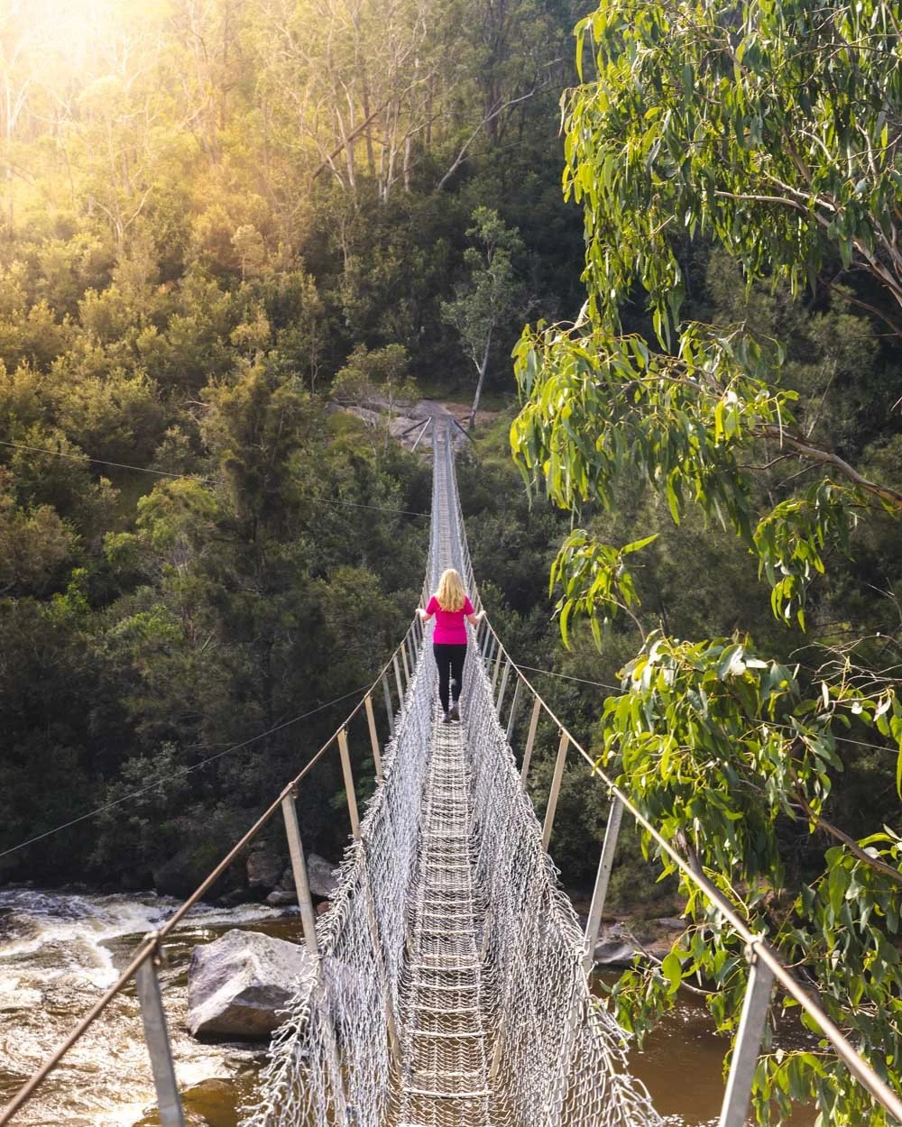
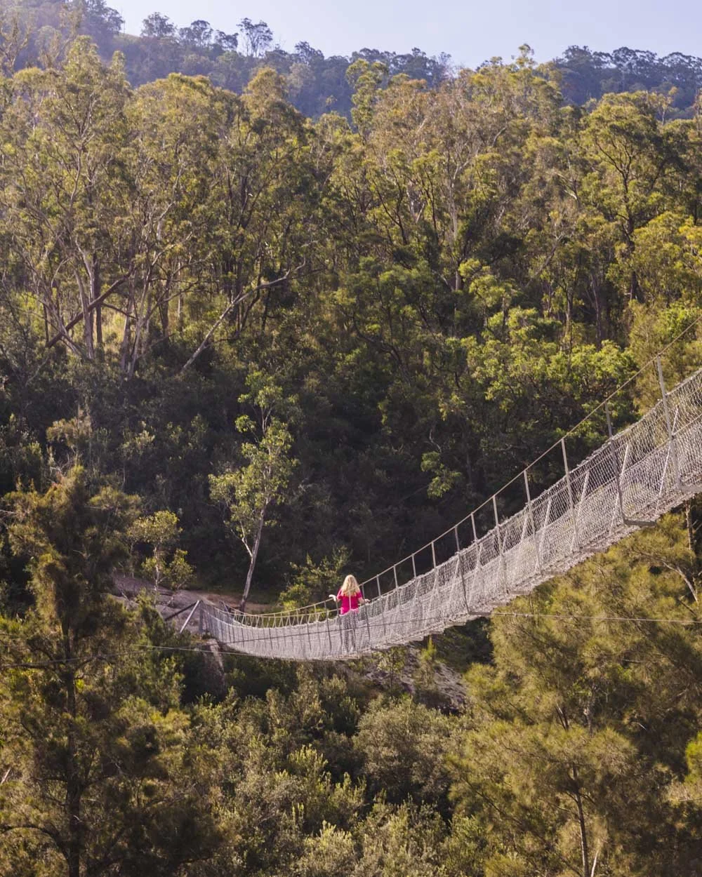
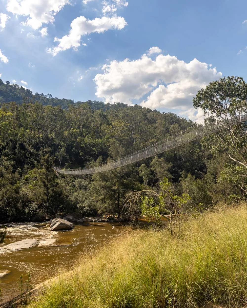
Arriving at the Bowtells Swing Bridge
It’s hard to believe how long the bridge actually is - a staggering 100m - and you don’t really get a good feel for it until you’re actually crossing. It looks impressive from the end of the trail, but it’s even better from part way across.

You’ll walk up on to the bridge and straight away get some fab views of the river. Granted, for us it wasn’t quite as picturesque as it would normally be due to the river colour, but it was still incredible to see.
As you begin to cross, the bridge gets more wobbly and you can look down through the wires and straight into the cascades below.
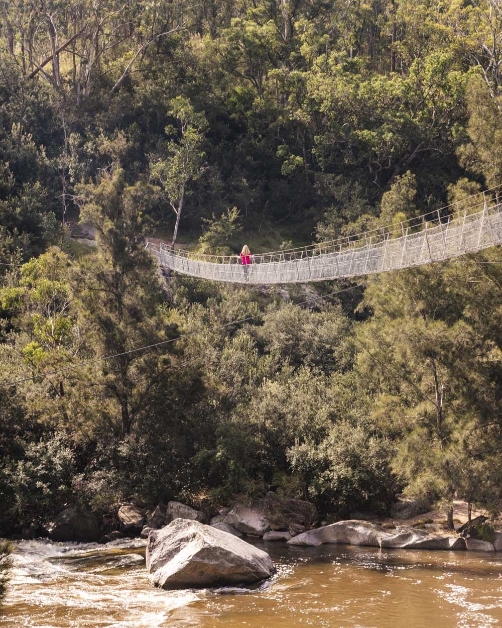
It’s one of those bridges that is actually quite hard to cross without at least one hand on the wires! It’s lots of fun and providing you aren’t scared of heights you’ll probably want to go back and forth a few times taking it all in.
If the trail through the bush has been webby, watch out for giant webs on the sides of the bridge too. It took me a moment to realise that every single space was occupied by giant webs and by that point I’d put my hands into several!
It’s good to have a stick or walking poles to clear your way a bit and then you can relax and enjoy!
Once on the other side the trail continues towards the Coxs River Campground, which you could stay at if you want to spend some more time in the bush.
You could also stay at the Six Foot Track Ecolodge (900m away) if you’re visiting on a weekend (you’ll want to prebook ahead of time).


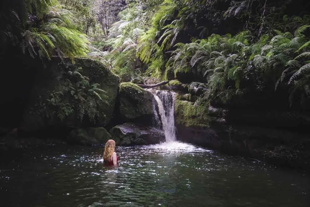
If water levels allow, you can take a dip in several spots close to the bridge.
We’d initially planned this trip hoping the water level would have receded enough to scout some good swimming spots, but unfortunately it didn’t pan out that way. Hopefully you will have more luck!

Heading back
The way back has the vast majority of the elevation gain (about 350m), but it’s not too bad. There is enough flat track that it never feels like you’re climbing for too long.
Depending on what time you’re heading back you might spot some kangaroos in the bush.

We were walking late afternoon and saw many, which made the walk back even more enjoyable. Once you hit the farmland you’ll also get those incredible mountain views, which makes for a lovely end to the walk.


Getting to the trailhead
The walk begins at The Megalong Cemetery on Megalong Road. There was a sign saying not to leave any valuables in the car, but we didn’t have any issues.
It’s roughly 140km (2 hour drive) to Sydney and 26km (30 minute drive) to Katoomba, the road is sealed all the way.
There are no facilities at the trailhead or anywhere along the way. Please remember to pack out all rubbish with you.
This post may contain affiliate links, meaning at no additional cost to you, that we will earn a small commission if you click through and decide to make a purchase. This helps towards the costs of running our website. Thanks for your support!