Leura Cascades is one of the most visited waterfalls in the Blue Mountains, but few people realise that the most magnificent part of the waterfall is actually the very bottom: Leura Falls. There are no signposts to guide you there, but it’s only a few hundred metres from a marked track.
You can visit as part of a spectacular circuit walk, which takes in glorious rainforest, several more waterfalls and lots of stunning cliff top views.
Here’s everything you need to know about the Leura Falls and Amphitheatre Track.
Leura Falls and Amphitheatre Track
The stats
Distance: 4.5km circuit
Elevation gain: 300m
Difficulty: Moderate
The Leura Falls walk can be done in a couple of different ways, but we love this circuit walk best. There are quite a few staircases to climb across the course of the track, but there are plenty of places to stop along the way.
Just a few hundred metres of the walk are off track, but you’ll want to take extra care on this section as it is no longer maintained by the parks service. Aside from the final section, the rest of the trail is in great condition.

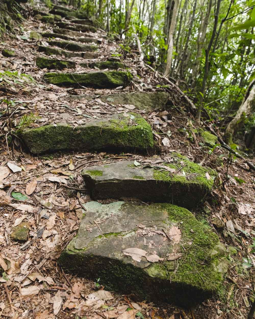
Starting the trail along the Dardanelles Pass
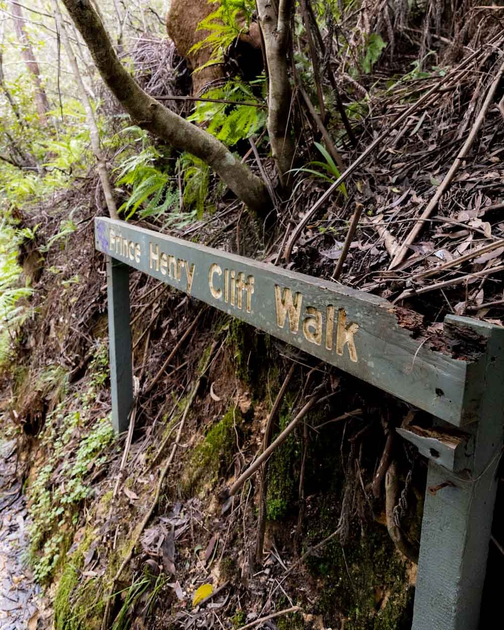
The trail begins by Carrington Park on Cliff Drive (exact start point below). From the road, the path heads straight down the stairs and into the bush following the signpost for the Prince Henry Cliff Walk. After 40m you will come to a junction and head left.
This part of the track can get quite waterlogged and muddy after rain, but it’s flat and easily passed through.

A couple of hundred metres later you’ll reach another junction and head right, following signs for the Federal Pass.
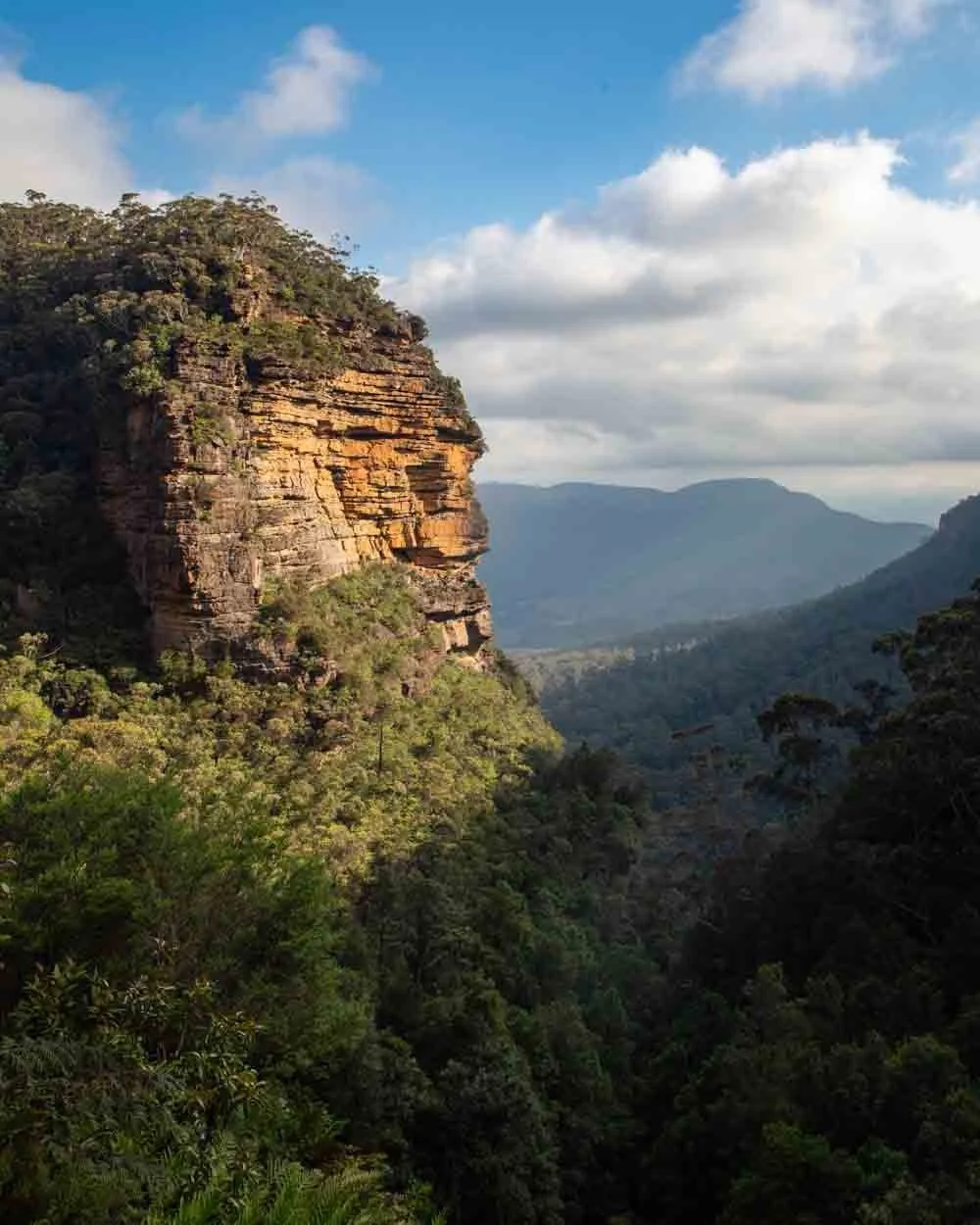
You’ll quickly see a lookout on the left which is just a few seconds detour and offers lovely valley views.


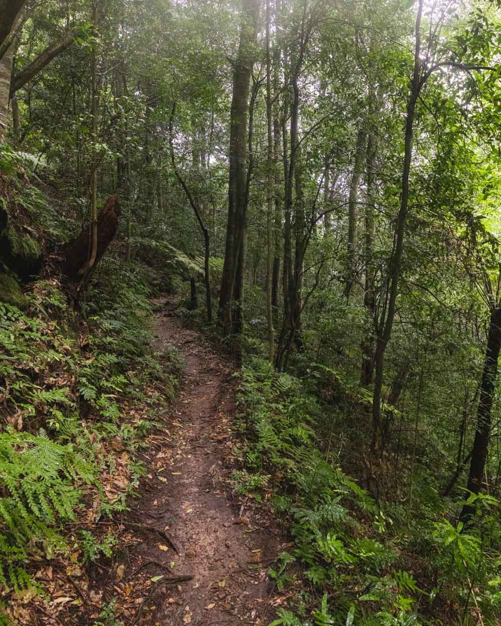
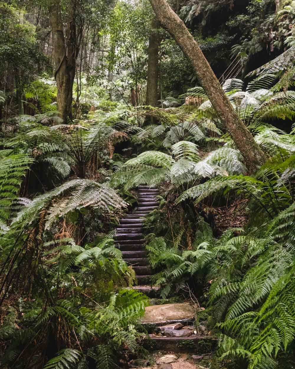
From here you’ll begin descending deep into the rainforest. It’s a gorgeous stretch of track, with a thick canopy which keeps it shady and fairly dark even on a bright day.

There are masses of ferns, trickling cascades, giant overhangs and plenty of hanging vines.
The track is all very well maintained and though the descent is steep at times, it’s all on well formed track.


Getting deeper into the rainforest
After 1km you will reach a junction and head right towards Leura Forest and Echo Point. This is a steeper part of the walk where you’ll descend deeper into the forest on a series of metal staircases.
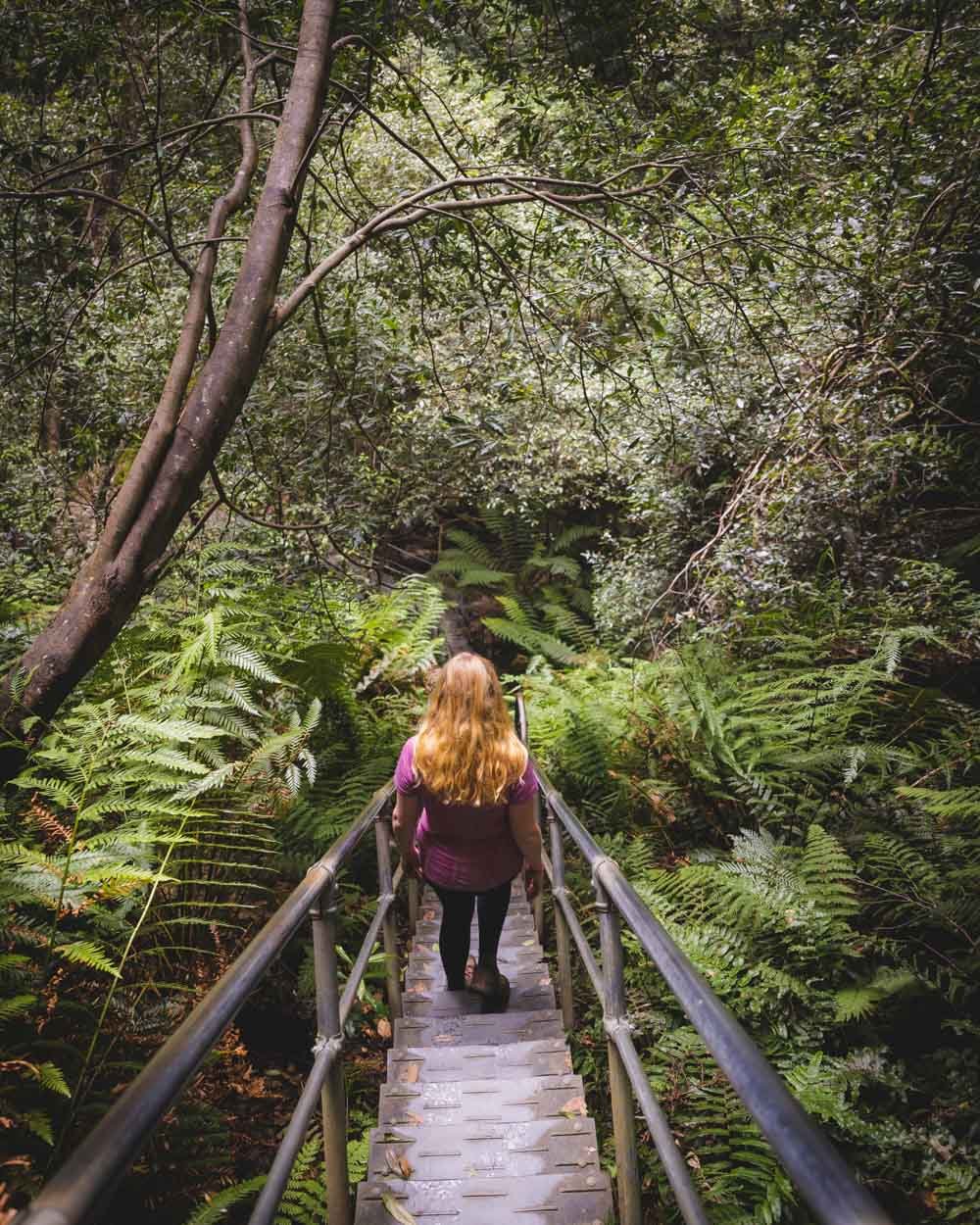
It’s steep, but the excellent track makes it quite easy and there are always handrails if you need extra stability. If you look underneath the metal stairs, you can sometimes catch sight of the old track which would have been quite the adventure!


You’ll soon pass Lila Falls, which is more of a weeping rock than a waterfall, but quite mesmerising to watch.

Just 70m beyond Lila Falls, (1.4km into the track) you’ll arrive at Linda Falls.
A narrow but impressive ribbon of water that flows through a chasm and into a shallow pool at the base. As with all waterfalls in the mountains, they can reduce to a trickle in dry periods and are best visited after rain.

Almost immediately after leaving Linda Falls you will begin the short off track part of the walk.

Heading to the bottom of Leura Falls
The trail to the bottom of Leura Falls is un-signposted and begins just 3m beyond Linda Falls.
It’s directly opposite a trail sign showing “Leura Forest To Federal Pass & Dardanelles Pass” in one direction and “Katoomba/Leura” in the other.


You’ll see a rougher trail heading uphill on the left - you can’t miss it if you know it’s there, but otherwise you’d likely walk straight past it.
You’ll almost immediately come to a warning sign which outlines that the track is unmaintained. You are now just 300m from the bottom of the falls.

The path is very easy to follow, but narrow at points and can be prone to rockfall, so it’s best not to visit directly after very heavy rain.
Most of the path is flat but there are a few ups and downs, much of which is on stairs, but one very short section has a covering of pine needles and can be a little slippery. There are trees to grab if you do feel unstable though.


You’ll have to cross a small creek which is easy enough in dry conditions - but again not after very heavy rain.

After just under 300m you’ll see the falls ahead of you and there is just a short 2m climb down a slightly more worse for wear part of the path.
It’s a little crumbly but again there are plenty of tree roots, so it’s quite easy, and just requires a little extra care. From the start of the walk to the bottom of the falls is 1.7km.


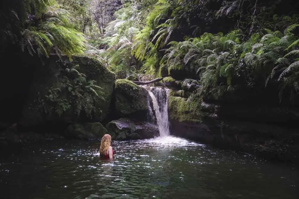
The bottom of Leura Falls
From the end of the track you have a fantastic view of the falls. It thunders over the cliff edge and the towering walls give it a dramatic feel.
It’s definitely one of the most impressive waterfalls in the Blue Mountains.

Ideally you want to visit after some decent rainfall, but leave it a couple of days if it’s been really heavy, so that the track is more stable. We visited around a week after extremely heavy rain and it still looked amazing.
There are lots of rocks where you can sit and enjoy the view, although unfortunately for us, it unexpectedly began pouring with rain which cut our time here a little short.
It was spectacular nonetheless and the kind of spot I could have sat for ages if the weather was in our favour.

After visiting the falls you retrace your steps back along the unmaintained track to meet the main path again.
From here you can follow our route along the Amphitheatre Track, or take the Dardanelles Pass back to your start point via the Giant Stairway.
Both form fabulous loop walks. In the post linked above we have all the details on the track from Linda Falls back to your car via Dardanelles Pass, and in this post we’ll be describing the route via the Amphitheatre Track.
The Amphitheatre Track
To reach the Amphitheatre Track you need to retrace your steps for a further 400m back up several staircases to the junction with Lila Falls and Bridal Veil Falls (it’s all signposted).
From the junction head right along the track marked as Leura Cascades and Bridal Veil Falls.
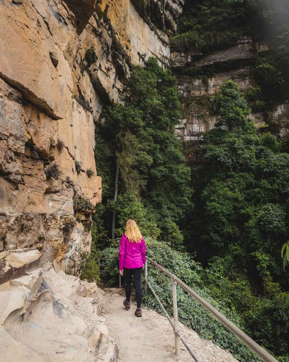
It’s flat and easy and passes a long picturesque overhang with amazing mountain views.
Unfortunately this gorgeous 100m section of track is prone to rockfall, so you can’t linger, but you can still take it all in as you walk past.
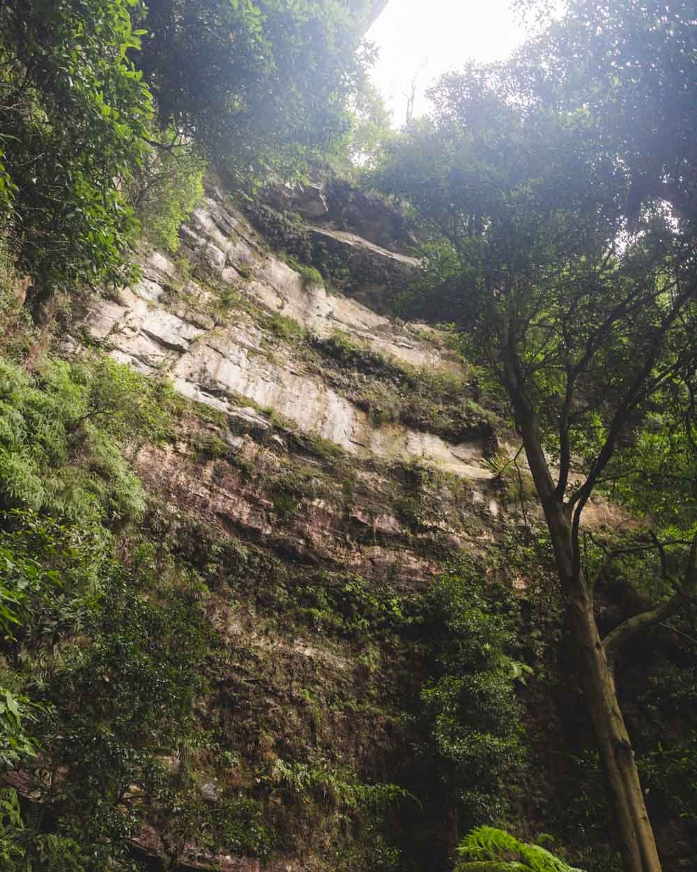
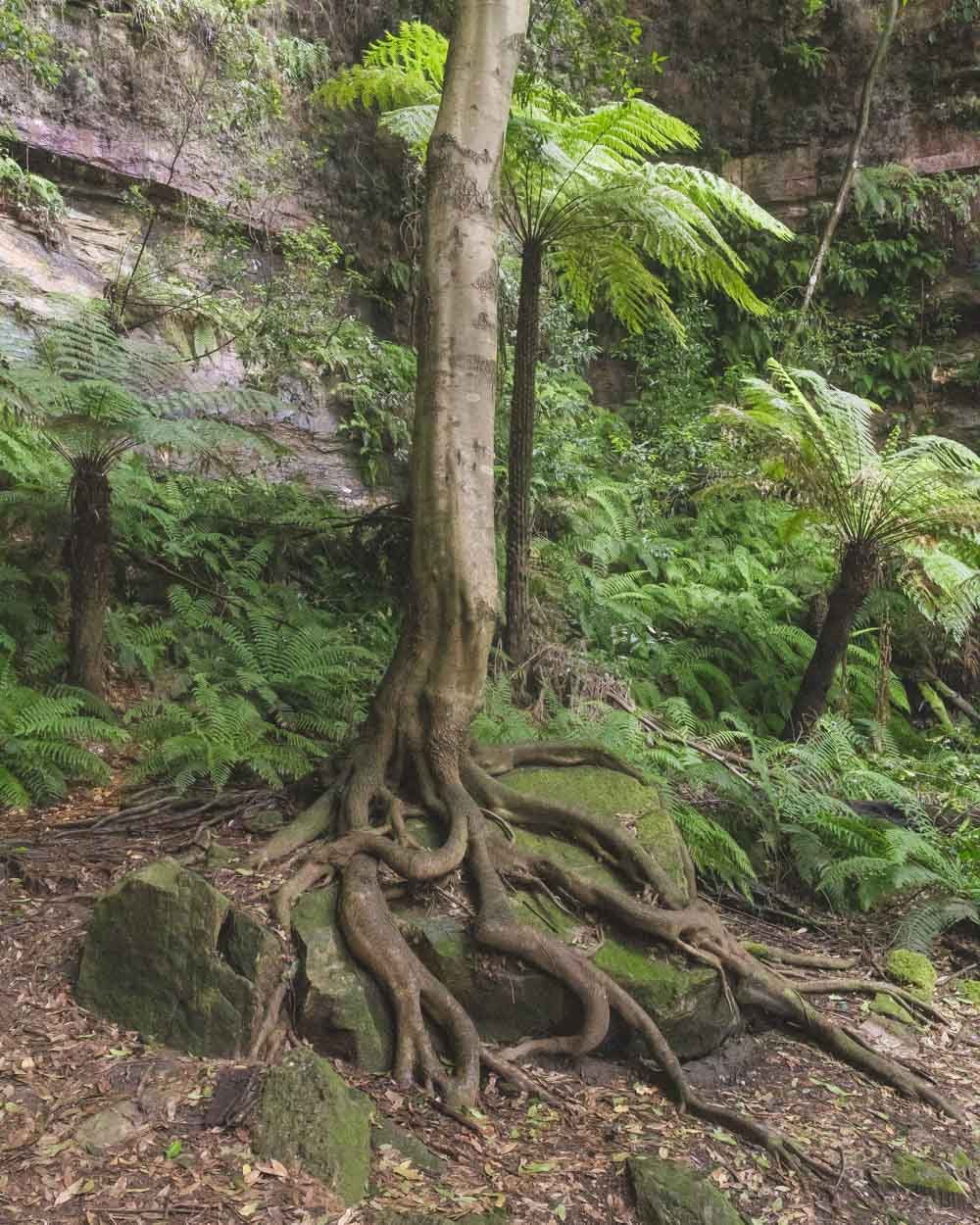
You will then arrive at the Amphitheatre, which is just 250m from the junction. It’s an incredibly atmospheric spot especially on a misty day when it feels dark and mysterious.
The cliffs enclose a patch of wild rainforest and there’s a prominent tree with amazing curved roots.
The track continues through the Amphitheatre and heads gently downhill before arriving at Weeping Rock 350m later.

To yet more waterfalls
Weeping Rock might be small but it’s a real beauty and roars after rain. It’s very much worth walking a few steps off track to see it from a closer vantage point than the main track allows.

There are lots of giant mossy boulders and picturesque tree ferns which make it even more beautiful and it’s a lovely place to sit and relax in the shade.
You can even climb the stairs carved into the rock and sit directly in front of the falls which offers the most stunning view.

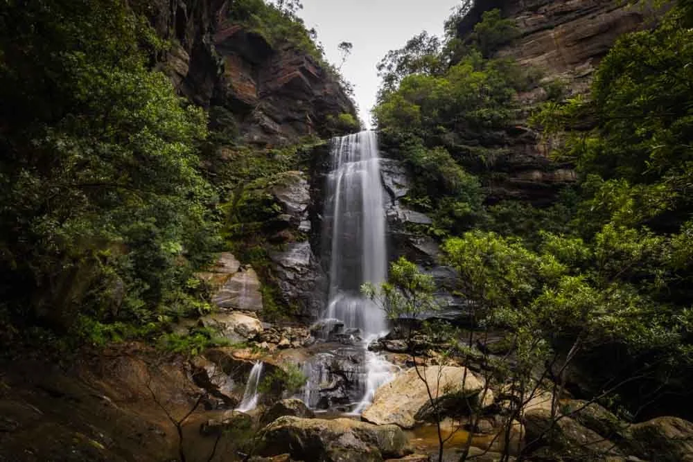
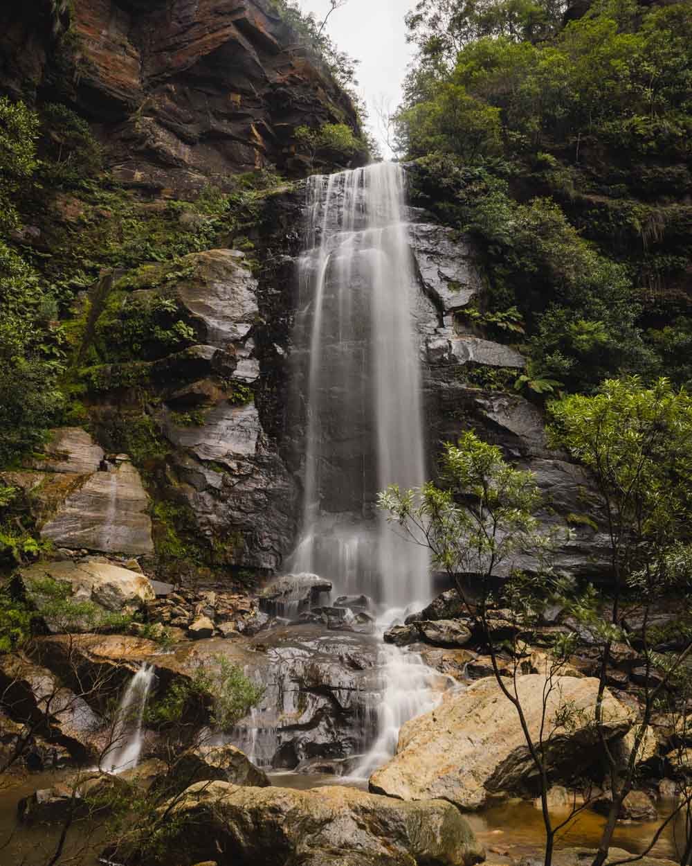
You can see Bridal Veil Falls towering above Weeping Rock and it’s probably one of my favourite waterfall views in the park.

From Weeping Rock, it’s just 50m up the stairs to the base of Bridal Veil Falls.
Unless there has been extremely heavy rain, Bridal Veil Falls is never that powerful because it flows over a huge cliff which is so wide that the water only thinly covers the large surface area.


Despite this it’s an impressive sight and definitely one of the more unusual looking falls in the area.
Onto the viewpoints
From Bridal Veil Falls you begin climbing back up to the car park. You will enter another patch of dense rainforest, much like the start of the track, and it’s equally gorgeous.
The climb is either on well maintained wooden steps or very steep metal stairs with handrails.
It’s just 400m before you reach the first lookout which is a couple of seconds off the route you’ll take (on the right). It’s very much worth checking out the fab valley views.

I am guessing that anyone looking at this fairly off the beaten track walk will already have visited Leura Cascades, but if you haven’t, the main viewpoint is a 120m detour from here and well worth the little extra effort.
Assuming you have seen them already, you will take the path on the left which begins heading up yet more stairs. After 200m there’s another junction where you will head left following the sign for Echo Point.
The path flattens briefly along some pretty overhangs before heading up a few more staircases.

Just 200m from the junction you’ll see Bridal Veil Falls Lookout on your left, it’s less than 10m off the main track and offers a good view of the top of the falls and the surrounding valley.


Finishing the loop
From the lookout you are now just 550m from the end of the walk, that is unless you detour to more lookouts, of which there are many!
From the Bridal Veil Lookout the path heads uphill and passes two lookouts: one is seconds off the track and worth seeing, and the other (Copeland Lookout) we didn’t check out this time, but is probably not that far judging the short distances to reach all the others.

You’ll soon find the track takes you up a few more stairs and out onto the road (4.1km into the walk). You need to head left and within minutes you’ll see the path that takes you back into the bush again.
Follow the now mainly flat track and turn right at the junction at the 4.5km mark. You are then just minutes from the main road and the lay-by where you left your car.

Getting to the trailhead
The start of the walk is located in Katoomba, roughly 1.5 hours from Sydney. You can park in the lay-by at the junction between Merriwa Street and Cliff Drive, you can find it on Google Maps here.
You can also walk here from Katoomba town centre, which we have done before, but it does add on a few extra kilometres and some more hills!
This post may contain affiliate links, meaning at no additional cost to you, that we will earn a small commission if you click through and decide to make a purchase. This helps towards the costs of running our website. Thanks for your support.