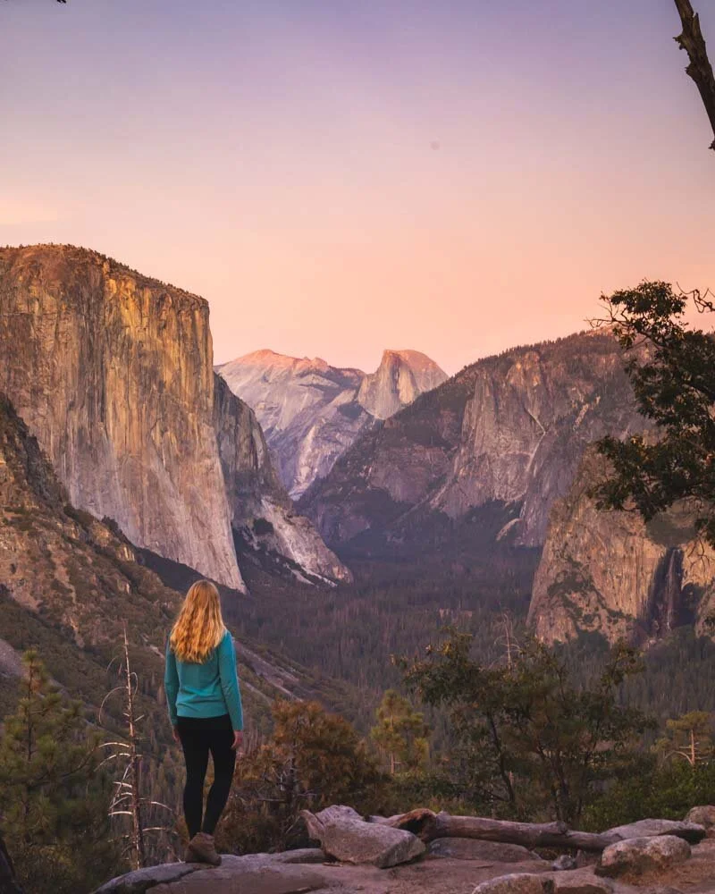
Yosemite lives up to the hype. Simply put, this is one of the greatest national parks we’ve ever visited and Yosemite’s hikes were truly memorable. There’s something for everyone from easy flat strolls to some of the steepest and most adventurous hikes we’ve ever taken on. We’re covering the best of both here.
This is not a round up blog using parks material, we have hiked every single one of these trails so you can trust us for first hand advice.
One thing to know when planning which Yosemite hikes you want to take on is where they are located, some of the best don’t go from the valley floor, but the Tioga Pass and Glacier Point Roads - which are both an hour or so drive from the valley floor.

The 16 Best Yosemite Hikes
Yosemite has some of the best day hikes in the world and we strongly recommend taking on at least one of the more difficult ones for a good challenge and a great reward. With some training in the weeks before you go, we believe that the majority of people can take on one of the harder hikes in the park - just look how many non hikers climb Half Dome!
Whilst we are suckers for the brutal and gruelling hikes, there are plenty of easy going trails in the park which we also checked out.
After spending over a week hiking ourselves to exhaustion we’ve put together a comprehensive list of the best Yosemite walks you need to put on your list.
Best for thrill seekers: Half Dome
Best for the view: Cloud Rest
Best sunset hike: Sentinel Dome
Best easy hike: Taft Point
Best moderate hike: North Dome
Best epic hike: El Capitan
-
1: El Capitan hike (Brutal)
2: Half Dome (Hard)
3: Clouds Rest (Moderate - Hard)
4: Upper Yosemite Falls (Moderate - Hard)
5: The Mist Trail (Moderate)
6: The John Muir Trail to Nevada Falls (Moderate)
7: North Dome (Moderate)
8: Lembert Dome Circuit (Moderate)
9: Inspiration Point (Moderate)
10: Taft Point (Easy)
11: Roosevelt Point & Sentinel Dome (Easy)
12: Sentinel Meadow / Cooks Meadow Loop (Easy)
13: Mirror Lake (Easy)
14: Lower Yosemite Falls (Very Easy)
15: Bridal Veil Falls (Easy)
16: Gaylor Lake (Easy - Moderate)
Yosemite hikes map
The hikes in Yosemite are split into three areas: the valley floor, Tuolomne Meadows (Tioga Pass) and those along Glacier Point Road.
These areas may look close on the map, but are between 30 minutes to 1 hour drive apart! We recommend planning your hikes by grouping them together by location and considering your accommodation options accordingly.
You can see where each hike is located on the map below. If you want to see them on Google Maps, you can click this link.
The Best Hikes in Yosemite - The hard walks!
We’ll start with the epic challenging hikes before making our way down to the moderate trails and finishing with the easy ones.
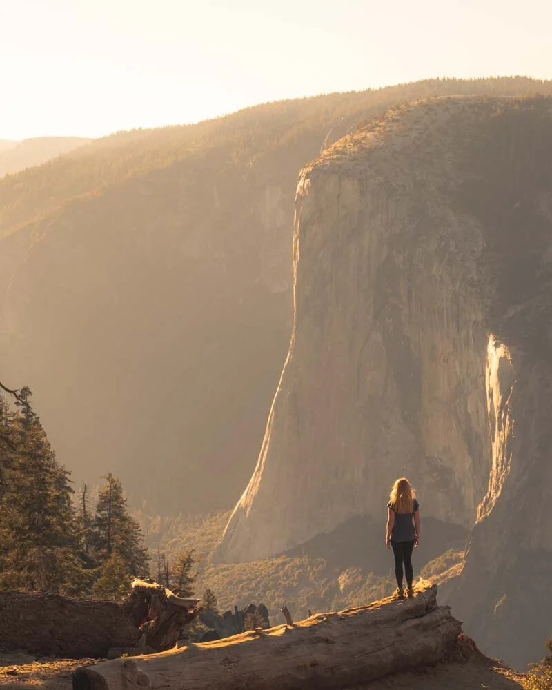
1 - El Capitan
Difficulty: Brutal
Distance: 19.4 miles (31.2 km)
Elevation: 5,219 feet (1,519 metres)
Time needed: 9-12 hours
Location: Yosemite Valley
Trailhead: Camp 4
Why we love this hike: It’s long and challenging but achievable for most hikers and you get to the top of the most famous spot in Yosemite!
You weren’t expecting that one were you?! Not everyone realises that you can actually hike up to the top of El Capitan, the iconic summit in Yosemite.
Whilst it has always been famous with rock climbers, it has drawn even bigger crowds since Alex Honnold climbed it without a rope in Free Solo (watch the documentary if you haven’t already, it’s an insane achievement!).
But if you’re not a climber you can actually hike up to the very top using the back route. This doesn’t mean it’s easy, and it’s the only day hike we have ever classified as “brutal”. It is a step up in difficulty from anything we’ve ever done.

The view from Eagle Peak
The summit of El Cap
The trail involves a gruellingly start up the steep Upper Yosemite Falls Trail before you hit a pretty stretch of forest which is predominantly flat, and offers some much welcome shade.
As you make your way through the forest, roughly two miles before the summit of El Cap you can add on a side trail to the stunning Eagle Peak for some impressive views - even better than those from the summit in our opinion. Our stats include this detour.
Following Eagle Peak you’ll complete the final section on an undulating trail before those without a fear of heights can go right to the edge of the cliff at El Cap!
It’s an epic all day hike, so ensure you leave early. At almost 20 miles long and over 5000ft feet in elevation, it’s one of the toughest in the park and the sense of achievement when you reach the top is incredible! You can read more on our post dedicated to the El Capitan hike.
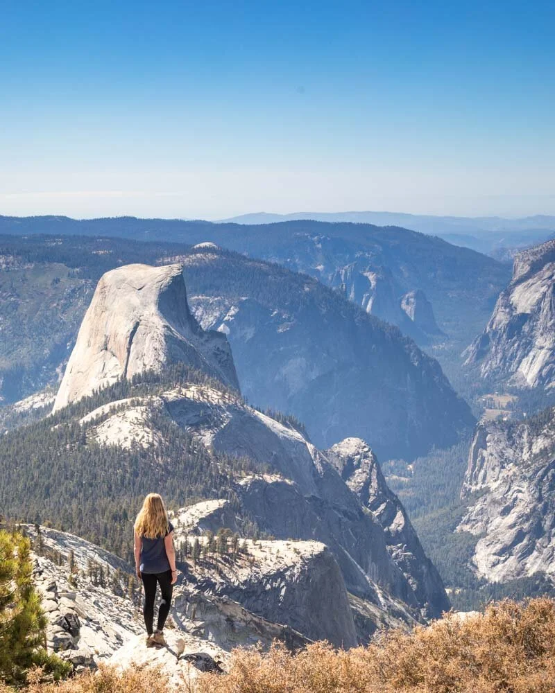
2 - Half Dome
Difficulty: Hard
Distance: 18.3 miles (29.5km)
Elevation: 4,665 feet (1,422 metres)
Time needed: 8 - 10 hours
Location: Yosemite Valley
Trailhead: Happy Isles/The Mist Trail
Why we love this hike: Until 1875 reaching the peak of Half Dome was deemed unclimbable. Climbing to the top is difficult, but a rewarding challenge.
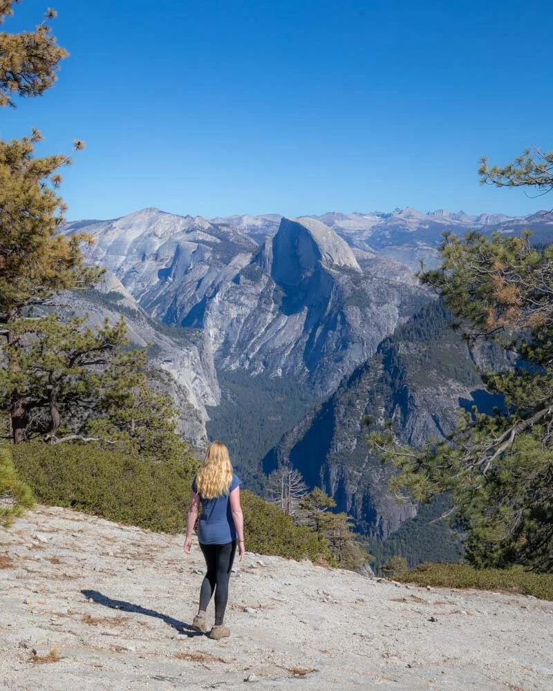
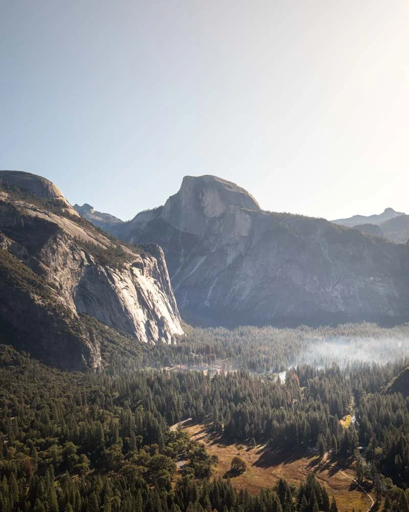
Half Dome dominates the Yosemite skyline and is visible from miles away. It’s a mesmerising dome and you can understand why John Muir thought it was impossible to summit for so long.
Well, he was wrong! It’s a big undertaking and requires a permit, but hiking to the top of Half Dome is one of the bucket list challenges in Yosemite.
This hike is not for the faint hearted and we don’t recommend anyone taking this on without some training. The hike is 18.3 miles long and 4,665 feet high and that’s before you get to the cables.
The hike to Half Dome takes in the Mist Trail on the way and John Muir Trail on the way back so it’s a 3 for 1 adventure!
There are sections of track which are very steep but also some long flat parts to catch your breath on before you hit the Subdome. Then it’s a pretty steep set of stairs to the foot of the famous cables.
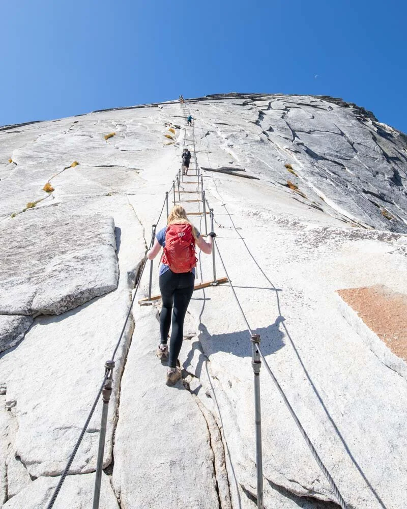
Climbing those infamous cables
This is the part which the thrill seekers love. The trail becomes a 45 degree climb up slippery granite for 400 feet. You have the help of steel wires to grab onto and wooden planks to rest up on, but we’re not going to lie, it’s truly terrifying.
The reward for completing this section is summiting a Yosemite icon, but it is certainly the most dangerous hike in Yosemite.
To be 100% honest with you we couldn’t make it to the very top, we freaked out following the ranger telling us a woman had died falling from the cables just two weeks before. Despite that disappointment we still rate it in our top hikes and we’ll be back to try again one day!
Make sure you read our post that details all the things no one tells you about the Half Dome hike before you take on this challenge.
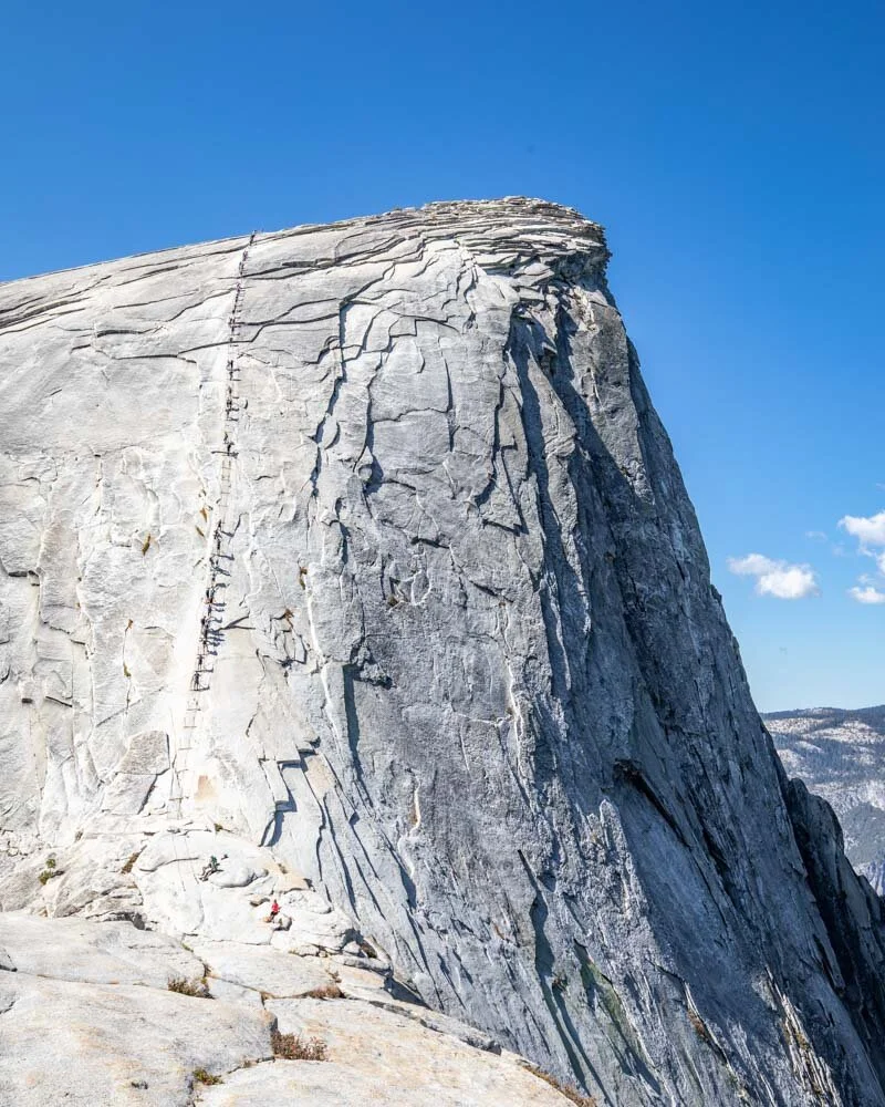
I’m sure this is the craziest hike we’ve ever seen!
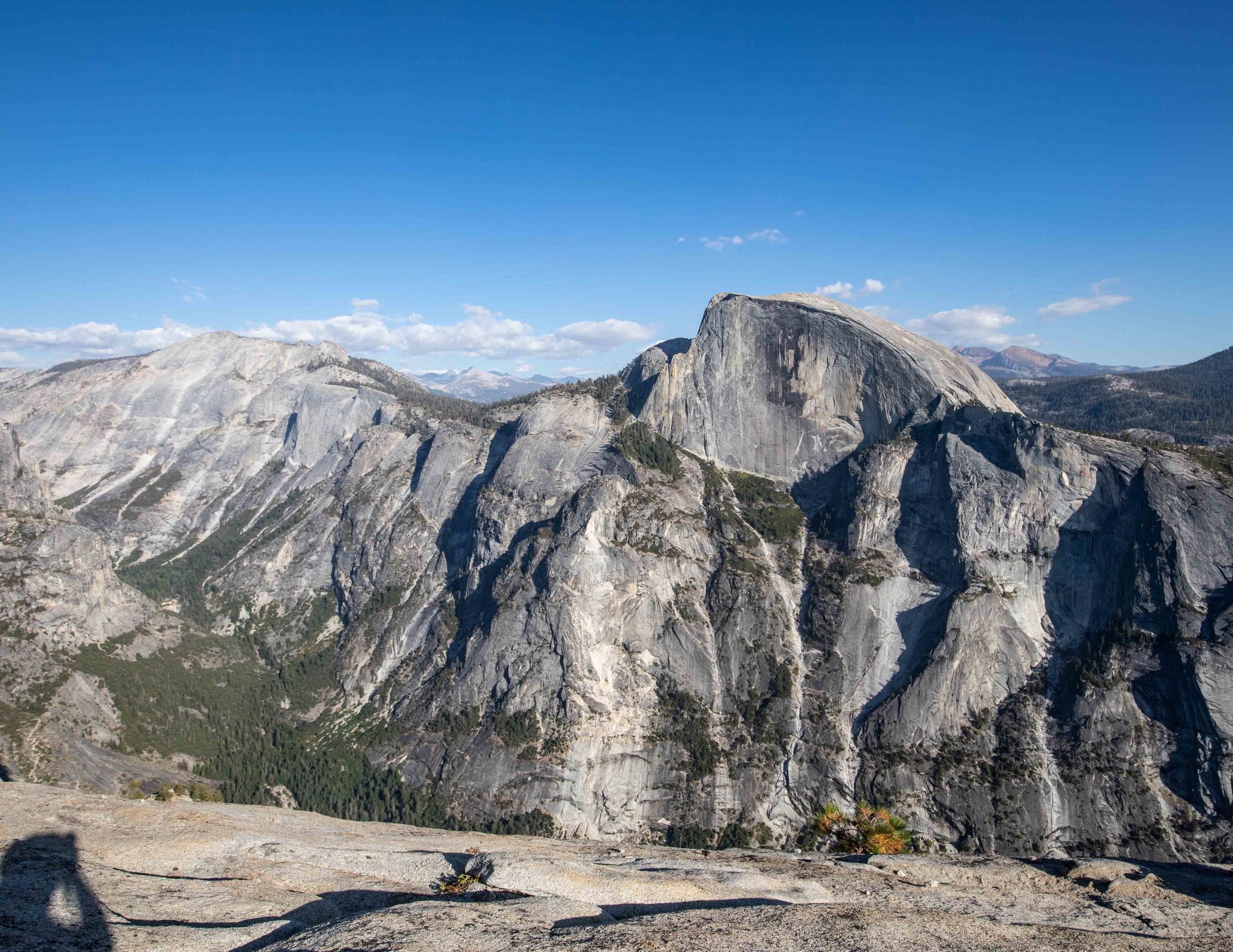
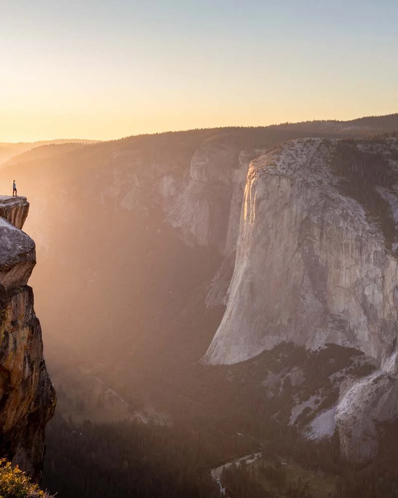
3 - Clouds Rest
Difficulty: Moderate - hard
Distance: 12.7 miles (200.5km)
Elevation: 4,860ft (920m)
Time needed: 5-6 hours
Location: Tioga Pass Road
Trailhead: Tenaya Lake (Sunshine Trailhead)
Why we love this hike: Clouds Rest offers one of the best views in Yosemite. This trail will take your breath away in more ways than one.
Those looking for similar views to those on the Half Dome hike - but without the fear of the cables - should head to Clouds Rest. In a lot of ways, this is a better trail, if only because you can see the iconic Half Dome - which you obviously can’t do when hiking on it!
The Clouds Rest hike is no walk in the park, and starts at 8,800 feet in altitude and heads to a summit that is nearly 10,000 feet above sea level. You’ll feel breathless from the altitude if you’re used to residing at sea level.
Half Dome from the summit of Clouds Rest
But the reward is well worth the effort. The ridge at the top is spectacular and the view from the summit is arguably the best in the park. It’s so high that you look down on Half Dome and El Capitan looks like a tiny cliff from here.
Simply put, Clouds Rest should be on your list of hikes you have to do in Yosemite. Here’s our detailed guide to what to expect from the trail.

Exploring the Clouds Rest summit
The best hikes in Yosemite - moderate difficulty
These are the hikes that will get your heart beating, and are a challenge, but aren’t all day epics that require starting before sunrise!
In many places in the world, a lot of these would be considered hard and many of them involve long steep sections. However, the pay off is worth the effort!
4 - Upper Yosemite Falls
Difficulty: Moderate - hard
Distance: 3.5 miles (5.65 km)
Elevation: 2,820 feet (860 metres)
Time needed: 3-4 hours
Location: Yosemite Valley
Trailhead: Camp 4
Why we love this hike: Brutally steep, but highly rewarding for the beautiful valley and waterfall views.
Gluttons for punishment flock to the Upper Yosemite Falls trail. At just over three miles each way, it doesn’t seem like it would be too bad until you realise it shoots up 2,800 feet in that time! This is one of the steepest hikes in the park (mile for mile) and there’s barely any break from the relentless stairs.
However, you will get some incredible views of Yosemite Valley and you’ll follow the iconic waterfall for the majority of the trail. Just make sure you don’t go in the Fall when it can dry up which is what happened to us and why we sadly can’t show you the falls in our photos.
The valley from the trail

Near the top of the trail
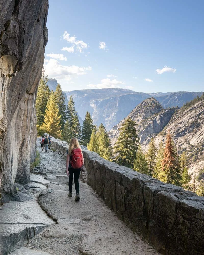
5 - The Mist Trail
Difficulty: Moderate
Distance: 5.4 miles return (all the way to Nevada Falls)
Elevation: 1,925 feet (586 metres)
Time needed: 2-3 hours
Location: Yosemite Valley
Trailhead: Happy Isles
Why we love this hike: An iconic trail, the Mist Trail leads up to a beautiful waterfall that is worth the uphill effort.
We have a confession to make, we did the Mist Trail in the fall. There was no mist, no fog and the trail itself was bone dry!
We’d read about how you can get a torrent of water thrown at you and that the path becomes really, really slippery but we didn’t see any of that.
The best time to hike this trail is in spring, if you hike in fall the waterfalls have some water but nowhere near the power they have earlier in the year.
The trail is pretty steep and took us first to the beautiful Vernal Falls. From here the track continues uphill before reaching Nevada Falls which you can see from below and then above as you climb higher.
The views are sensational year round, but in spring and summer when the waterfalls are pumping this would be a true bucket list hike. As you walk right beside the falls for certain sections expect to get wet!
It’s a beautiful hike and one can comfortably fit in with other trails. You can even choose to return via the next trail on our list.

The Mist Trail

Vernal Falls
6 - John Muir Trail to Nevada Falls
Difficulty: Moderate
Distance: 8 miles return (but 1.5 miles less if you do the Mist Trail one way)
Elevation: 1,925 feet (586 metres)
Time needed: 2-3 hours
Location: Yosemite Valley
Trailhead: Happy Isles
Why we love this hike: A trail often overlooked by day hikers, the John Muir Trail offers beautiful views with less crowds.
The full John Muir trail to Nevada Falls stretches for four miles, but rather than using the JM both ways, we’d recommend using the Mist Trail one way to add variety.
Assuming you’ve taken the Mist Trail to the top of the Nevada Falls you’ll then follow the John Muir along the cliffside which has great views.
The descent back to the valley floor is on switchbacks so it’s rarely overly steep which is why people generally prefer ascending on the very steep Mist Trail and descending on the John Muir.
Be careful though, as the path is quite slippery due to a fine layer of sand covering the stone. We found on certain points we were desperately trying to stop ourselves from going over (not literally over the edge we hasten to add but just over on our bums!).

Fantastic scenery along the John Muir Trail
The start of the JMT runs alongside the cliff edge
7 - North Dome
Difficulty: Moderate
Distance: 9.5 miles return (including Indian Rock)
Elevation: 2,000 feet
Time needed: 4 hours
Location: Tioga Pass Road
Trailhead: Porcupine Creek
Why we love this hike: A blissfully quiet trail which leads to an epic viewpoint
North Dome is often overlooked by hikers, as it is along the Tioga Road which is a fair distance from the valley floor. Their loss is your gain!
Starting from Porcupine Creek, the trail heads gently downhill through a beautiful forest with lots of deer, before turning into a bit of a scramble on the final stretch to the top of North Dome.
Along the way you can make a short detour to check out Indian Rock which we’d recommend. The section through the forest is easy but when you hit the granite the route is a bit less obvious and gets a little steeper at times. We’ve outlined how to find the easiest route to the summit in this post.
The views from the top of North Dome are breathtaking, especially if you want a great view of Half Dome.

The views from the summit of North Dome
It is quite exposed on the dome, so be careful as the winds can be really strong, especially towards the end of the day.
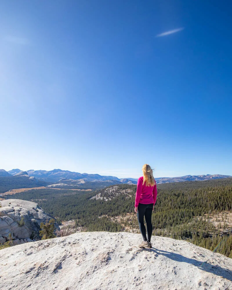
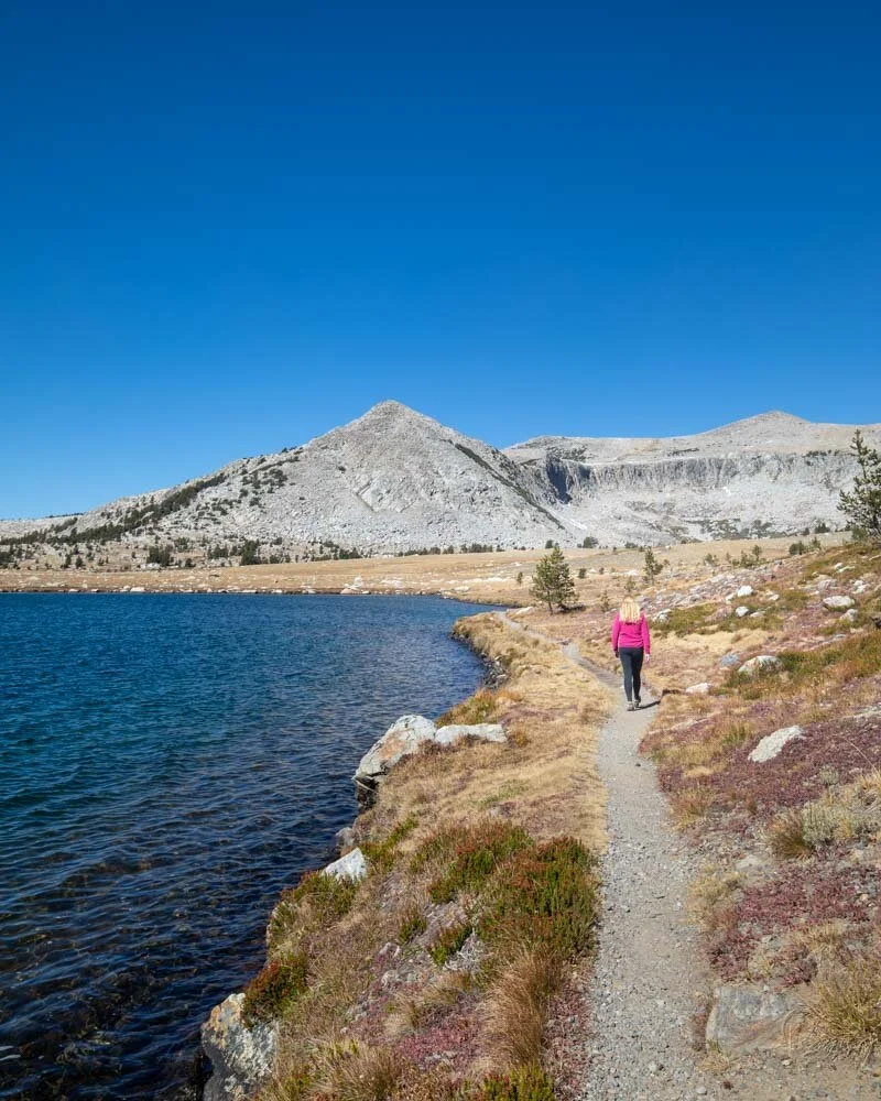
8 - Lembert Dome Circuit
Difficulty: Moderate
Distance: 5 miles (8km)
Elevation: 1,000 ft (300m)
Time needed: 2 hours
Location: Tioga Pass Road
Trailhead: Lembert Dome Picnic Area
Why we love this hike: A fun scramble and a beautiful lake, showcasing a different side of Yosemite.
Lembert Dome is in the heart of the Tuolomne Meadows and feels like a different park to the Yosemite Valley. This hike is a loop that takes you to Dog Lake, the top of Lembert Dome and back again along a different route.
Anywhere else in the world, Dog Lake would be a popular spot with tourists. But this is Yosemite which is blessed with so many amazing spots that places like Dog Lake go unnoticed!
It’s a beautiful spot to take in the view and enjoy a quiet and peaceful area of the park that sees far fewer visitors. The trail to get there is uphill but not as steep as many other Yosemite hikes.
From Dog Lake it’s uphill a little more to the summit of Lembert Dome, a short scramble up an exposed dome. From the top you feel like you can see the whole of the Tuolomne Meadows.
Just be careful as the rock is very exposed, it’s not slippery in dry weather but we definitely wouldn’t come up here if it has just rained.
You can read more details on the hike in our dedicated Lembert Dome post.
The top of Lembert Dome

Dog Lake
9 - Inspiration Point
Difficulty: Moderate
Distance: 2.5 miles
Elevation: 1000ft
Time needed: 1-2 hours
Location: Yosemite Valley
Trailhead: Tunnel View Parking Lot
Why we love this hike: A stunning sunset view
We’ll be honest, we actually meant to go to Artists Point, but missed the turning and ended up at Inspiration Point! Artist’s Point is a much shorter and easier trail, but sunset at Inspiration Point is stunning and it’s very unlikely that you’ll be there with anyone else.
Make sure you give yourself enough time if you’re heading there for sunset too, as this hike is uphill all the way and pretty steep.
You know you’ve reached the viewpoint when there is a large opening and all you need to do is walk down towards it to get this stunning view. If you’re looking for other great sunset spots check out this post.
The view from Inspiration Point
Best hikes in Yosemite - the easier ones
These are the six trails you should look at if you want a primarily flat, and leisurely walk. Trails like Taft Point and Sentinel Dome are some of our favourites in the entire park, offering jaw-dropping views without the need to scale up a mountain!
Even if you love your hard walks, don’t miss on these easy walks. They are still absolute gems.
10 - Taft Point
Difficulty: Easy
Distance: 2.2 miles
Elevation: 370ft
Time needed: 1 hour
Location: Glacier Point Road (closed in the winter)
Trailhead: Taft Point Trailhead parking lot
Why we love this hike: Taft Point is one of the most photogenic spots in the park. If you want an epic photo, this is the place to go.
Taft Point is on this list primarily for the stunning view at the end rather than the hike itself. The trail is pretty short and easy and is in the forest for the majority of the trail, but it soon opens up to a huge cliff edge.
Then you’ll see the iconic photo spot! You’ll see El Capitan and the valley in front of you and it is nothing short of mindblowing!
This beautiful spot gets even better at sunset as a golden glow is cast over the valley. The only downside is that this is a popular place for sunset, so you won’t be alone. For that w'e’d recommend the next place on our list….
The view from Taft Point
11 - Roosevelt Point & Sentinel Dome Loop
Difficulty: Easy - moderate
Distance: 6 miles (9.7km)
Elevation: 655 ft (200m)
Time needed: 2 hours
Location: Glacier Point Road (closed in the winter)
Trailhead: Taft Point Trailhead parking lot
Why we love this hike: This is the best place in Yosemite for sunset.
Top Tip If you want a shorter walk you can visit Sentinel Dome alone on a 2.2 mile return walking track.
Whilst everyone heads off to Taft Point, virtually no one goes to Sentinel Dome and even fewer go to Roosevelt Point.
Roosevelt Point
These gems are some of the best views in the park and getting them to yourself or with just a few others only adds to the magic. The view of El Capitan from Roosevelt Point or the top of Sentinel Dome is nothing short of sensational. You just can’t miss it from your Yosemite itinerary.
Sentinel Dome is a special place as it is one of the few viewpoints which offes a full 360 degree view. From here you can see both Half Dome and El Capitan. The walk is fairly easy and though there is some forest walking there are views for much of the way. It ended up being one of our favourites in the whole park.
Make sure this is high on your list as it is a truly special place. We have the full track details in this guide.
El Cap from Sentinel Dome

Half Dome from Sentinel Dome
12 - Sentinel Meadow/Cook's Meadow Loop
Difficulty: Easy
Distance: 2.25 miles (3.6 km)
Elevation: Flat
Time needed: 45 minutes - 1 hour
Location: Yosemite Valley
Trailhead: Lower Yosemite Falls shuttle stop
Why we love this hike: A really easy and casual hike with beautiful views and wildlife.
The meadows in Yosemite are beautiful and there are few easier hikes in the park that offer such good views. The trail is a simple loop from the shuttle stop at Lower Yosemite Falls, round to the Swinging Bridge and back again.
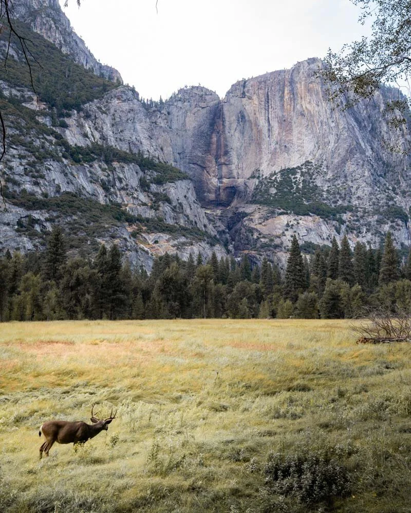
Along the way you’ll see a great view of Half Dome, follow the river and you’ll probably see a few deer as well. It also offers one of the best views of Lower Yosemite Falls on the return portion of the circuit (it’s the spot where all the Instagrammer’s take their photos with the boardwalk) but obviously it was dry on our visit!
There is next to no incline, so anyone can do this trail. We recommend downloading google maps to your phone as it can get a little fiddly to find the way when the trail goes into the lodge.
But other than that it’s both easy and beautiful. We did this trail on our first evening and it was a wonderful introduction to the park.
Probably wondering why Yosemite Falls is dry as well
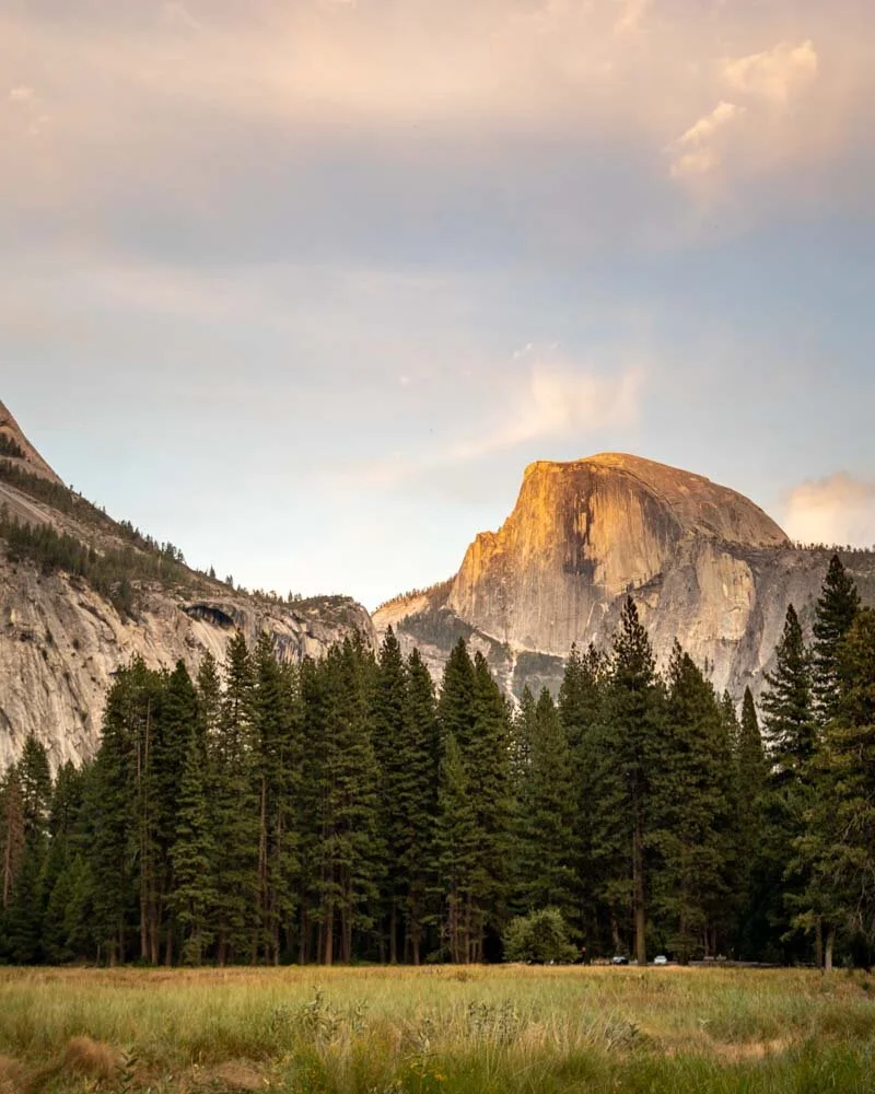
Half Dome from the meadows
13 - Mirror Lake
Difficulty: Easy
Distance: 4.8 miles (7.75 km)
Elevation: 460 feet (140 metres)
Time needed: 2 hours
Location: Yosemite Valley
Trailhead: North Pines Campground
Why we love this hike: If it has water, this will provide the perfect reflection of Half Dome.
Mirror Lake is one of the premier attractions for day trippers as it is an easy hike to a lake with a beautiful reflection. If you visit in fall - yes you guessed it - it will be dry! Nonetheless it was still pretty but obviously far less dramatic than when there is water.
If you only walk to see the lake you can just do a return walk which is just two miles, if you want a longer hike you can do the complete circuit.
The trail heads very gently uphill through the forest until you come to the lake. This is where most people will stop but we chose to continue the circuit. The circuit continues around the lake on a largely flat or gently undulating trail.
It’s known as a good track for wildlife watching but as we went in the middle of the day we didn’t see anything. It’s a peaceful forest track and one which sees few visitors (past the lake itself). You will get some views of Half Dome on the return portion of the loop but the majority of the walk is forested.
We enjoyed it but the highlight is the loop so we wouldn’t suggest the circuit if you are low on time.
Where the lake should have been
14 - Lower Yosemite Falls
Difficulty: Very Easy
Distance: 0.5 miles
Elevation: Flat
Time needed: 15-30 minutes
Location: Yosemite Valley
Trailhead: Lower Yosemite Falls trailhead
Why we love this hike: A very easy walk which takes you up close to an iconic waterfall.
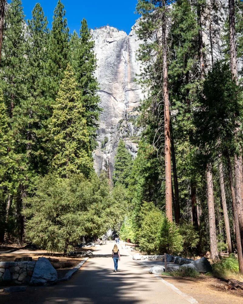
If the Upper Yosemite Falls sound like too much, then head to the Lower Yosemite Falls instead. This trail is a short paved track to the waterfalls and is suitable for everyone. It’s hard to believe such a flat, easy trail takes you to such an amazing view.
The path to the falls

Where Lower Yosemite Falls should be!
15 - Bridal Veil Falls
Difficulty: Easy
Distance: 0.5 miles (0.8 km)
Elevation: 80ft
Time needed: 15-20 minutes
Location: Yosemite Valley
Trailhead: Bridal Veil Falls Trailhead
Why we love this hike: Another very easy hike to a beautiful waterfall
Bridal Veil is another beautiful waterfall you can get close to and the trail here is also very easy. It isn’t completely flat but it isn’t far off, the majority of people will not have a problem with this hike.
The falls also had some water on our visit which was a bonus! You can walk up to a viewing platform or some people climb the rocks beside the base of the falls for a closer up look.

Bridal Veil Falls
16 - Gaylor Lake
Difficulty: Easy - moderate
Distance: 3 miles (4.97km)
Elevation: 975 feet (297 metres)
Time needed: 1.5 hours
Location: Tioga Pass Road
Trailhead: Gaylor Lake Trailhead (near Tioga Pass entrance at the east end of Yosemite)
Why we love this hike: The lakes are beautiful and we didn’t see another person on the whole trail!
The walk up to the first lake is steep. It’s through forest and the trail is pretty rocky. It’s short but it is a bit of a puff. When you get there though it will all be worth it.
The lake is beautiful and we sat beside it for a long time and didn’t see another soul, it was hard to believe it is in Yosemite! You can then continue the walk to a second lake which is also pretty, though our favourite was the first one.
That part of the trail is flat and only takes 5-10 minutes.

We had limited time so we turned back after the second lake but if you have longer you can climb Gaylor Peak which would offer some terrific views. If you are planning to hike the peak download a map in advance as we didn’t actually see where the trail to the top was.
Packing suggestions for Yosemite
Having the right gear can make a huge difference. Here’s what we pack and have relied upon for years:
Sunscreen: A lot of the trails in Yosemite have very little shade and the sun is brutal most of the year! Check for sunscreen on Amazon or REI
Day Pack: Osprey Talon 22 (we’ve owned this for years). Check on Amazon, REI or direct with Osprey
Hiking Boots: Merrell Moab (for men and women). We’ve both used these for over three years and they just keep going. Check them out on REI or Amazon
Trekking poles: We’ve used Black Diamond for years as they are light, solid and durable. Check out REI or Amazon.
Life straw: Something that it useful on the longer hikes as you can fill up and drink from the creeks. You can check them out REI or Amazon.
Reusable water bottle: To avoid single-use plastic. Check then out on REI or Amazon
Icebreaker Base Layer: What we always wear in the winter and makes a huge difference for keeping warm. Check out on REI or Amazon
This post may contain affiliate links, meaning at no additional cost to you, that we will earn a small commission if you click through and decide to make a purchase. This helps towards the costs of running our website. :-)
Like it? Pin it!


Follow us on social media
Are you planning a trip to California? Which Yosemite hikes are on your list? Let us know in the comments below!