

The Manly North Head Walk is a great loop track that offers fantastic ocean views, the chance to learn about Sydney’s military history, as well as explore the bushland and even take a side trip to the Quarantine Station. It’s a fun walk with plenty of variety and places to stop along the way.
It’s not a very hilly track so it’s great if you’re after something fairly leisurely and there are also a couple of options for knocking a few kilometres off if you’re short on time.
As well as all that, there’s even a good chance of spotting whales if you’re visiting between May and October. Here’s what to expect from one of Sydney’s best harbour trails.

Manly North Head Walk
The stats
Distance: 9 - 12km (depending on whether you do the side trails)
Elevation: 121m
Difficulty: Easy - Moderate
Type of trail: Loop
The Manly North Head loop is an easy to moderate walk. It’s not very steep overall but there is one climb up from Shelly Beach to the cliff tops.
The path is in very good condition all the way through and we recommend allowing 2.5 hours if you plan on doing the main walk, and maybe an additional hour or two if you want to do the side trails or stop at the cafe.
Insider tips for the trail
You can start the walk at Manly Wharf if you’re arriving by public transport or shave a couple of kilometres off by parking beside Shelly Beach if you’re coming by car.
There are several good cafes along the way so you don’t necessarily need to bring your own food, or you can supplement your picnic with a coffee or fresh juice part way through the walk.
There are several beaches along the way you could stop at so it’s worth packing your bathing suit!
You can walk the track in just a few hours or make a whole day of it by taking the side trip to Manly Quarantine Station which has a museum, tours and a cafe and restaurant.
Some of the return portion of the walk is on road but you can skip it if preferred by taking the bus instead.
If you wanted a really long hike you could walk all the way to Manly Wharf and the beginning of the North Head track from Spit Bridge. The full walk would be around 20km including the North Head. Here are the track notes for that walk if you’re keen.
If you aim to finish the walk around sunset, Manly has a couple of our favourite sunset spots in the whole city.

The track notes
Starting the trail at Manly Wharf
If you’re driving you can cut the first 1.5km of this walk off by parking at Shelly Beach, although it is a picturesque part of the trail.
Starting at the wharf, cross the road directly in front of you, and walk through the town, to Manly Beach. If you’re walking on a weekend, expect this first 1.5km to be manically busy. We were walking in winter and it was still heaving along the trail.

Manly Wharf

Manly Beach
Despite the crowds, walking alongside one of Sydney’s iconic beaches is a good start to the walk.
It’s a flat, paved walkway which takes you along the coast with ocean views the entire way, passing the pretty Fairy Bower Rockpool.
If you’re walking midweek or early in the morning on a weekend you might spot some of the Eastern Water Dragons but they tend to steer well clear of the track later in the day.

Fairy Bower Pool
After 1.6km you’ll arrive at Shelly Beach, it’s one of Sydney’s best snorkelling spots if you’ve got plenty of time.
It also has a Boathouse Cafe (like the one in Palm Beach) which does a good coffee if you want a pre walk pick me up.

Shelly Beach
Heading to the cliff tops from Shelly Beach
Take the staircase behind Shelly Beach and head left, you’ll see a couple of good - albeit similar - lookout points which offer expansive views of the ocean and back to Manly.
You then cross through the car park and head into the bush on the Blue Fish Track.
As you head through the bush the views are obscured but you’ll see a number of cut throughs to the cliff edges which offer good ocean views and excellent whale watching opportunities in season.

There are so many that if you find your chosen route already occupied, you can just carry on back up the bush track until you find the next cut through. After 300m you’ll come to an official lookout which is railed and has a bench to relax on if you prefer.
This whole section of track is uphill but it’s not overly steep and you can take your time, stopping at the views if you need.
On to the Barracks
Carrying on from the lookout, after 100m you’ll reach a hole in the wall with a gate (no dogs are allowed beyond this point) and you pass through into the beginning of the old military area.

You’ve got a few more stairs to climb once you’re through the hole in the wall but you’re out of the bush and have great ocean views.
It’s also where you’ll see the track become a lot quieter if you’re walking on a weekend.
After the trail flattens out you’ll soon come to several turn offs for gun pits and an old commander post. They are less than 30 seconds off the trail in three separate turn offs.
We stopped to check them out but there aren’t any information boards so you won’t learn too much.
It’s essentially the concrete left over from the gun pits used in the Second World War to protect against a potential Japanese invasion that never happened.


A few hundred metres later you’ll cross over the road and head onto some metal boardwalk through the bush. We heard lots of Whipbirds on this stretch and it’s also where I’ve seen Echidna in the past, so keep your eyes peeled!
The boardwalk is largely flat, and it’s relaxing and leisurely after the climb up from Shelly Beach.
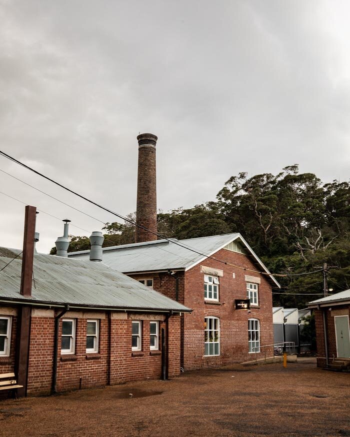
You’ll soon arrive at the old Barracks, you can’t explore inside the buildings but you can wander through the grounds.

The Parade Ground
Starting the Sanctuary Loop
Just past the main courtyard you’ll see a sign for a bike track, you follow that to begin the walk to Fairfax Lookout, this section is known as the Sanctuary Loop.
You can take a quicker route to the lookout, but we took the slightly longer option via the hanging swamps to form a loop.
You’ll head along a sandy cobbled path before taking a left turn onto metal boardwalk through the hanging swamps.
The water level was just below the boardwalk on our visit and it definitely felt more swampy than the ones at Botany Bay. It’s basically the same scenery as the bushland you have already walked through but a wet version, it’s peaceful and there are plenty of frogs providing a good soundtrack to the walk.

The Hanging Swamp
After 400m around the swamps, you’re back out on the cobbled path and heading for the gun tunnels which you’ll see just in front of you.
You can explore the tunnels, but only on a guided tour. They operate four times a day every Sunday and twice a day on Saturdays between November and February. We’ve not yet done this ourselves but you can find out more or book using this website.
If you’re not taking a tour there’s not a whole heap to see here and we carried straight on to the Memorial Walk.
The Memorial Walk
As part of the Sanctuary Loop you’ll pass through a couple of hundred metres of the Australian Memorial Walk.
There are five monuments commemorating service men and women during the World Wars, colonial times and peace keeping times.

The walkway has been beautifully done and there are the names of those who served and defended Australia carved into the paving stones.
Continuing on to the Fairfax Loop
You now make your way on to the Fairfax Loop which is a flat, paved path offering good ocean views, and your best opportunity to spot whales (other than the cliffs at Shelly Beach).

As you make your way round the loop you’ll also start to get some great views of the city. The most expansive are at Fairfax Lookout. You can see the city, and the cliffs of Watsons Bay jutting out in front of it. You can even see the very tip of the Harbour Bridge.
It’s definitely one of Sydney’s best viewpoints, and is especially pretty around sunset.

The view from the Fairfax Lookout
After the Fairfax Lookout you can make a left turn and continue along the road for 550m (it’s not a busy road) and you’ll come out at another scenic viewpoint.
It’s more bushy than Fairfax so it’s not as clear a view, but it’s still great and it’s also where the Bella Vista Cafe is. This is a great spot to grab some food or a drink and sit outside with the lovely view. The fresh juice was great!
Side track number one: the Hole in the Wall
We wanted to take this side track, but as you can probably tell from the photos in this post, the weather was quickly deteriorating - never trust the weather app so we didn’t make it this time! We’ll come back to update the post once we’ve been there but in the meantime, the Hole in the Wall is a secret viewpoint looking out over the cliffs.
It isn’t signposted, but we did find the trailhead so we can tell you how to get there. You need to walk along the road for 300m beyond the lookout and you’ll see a black fence, it’s right beside the bus stop.
Behind that fence (you can go round, not over) you’ll see the path. Again, we’re not sure about the condition of the track but we think it is around 400m each way. It’s also marked on Google Maps.
Side track number two: the Manly Quarantine Station
If you’ve never been down to the Quarantine Station before, it makes for a great side trip from the North Head Track. We actually got there following what we now know to be an unofficial track that’s closed, but was marked on Google Maps.
It’s 300m beyond the turn off for the Hole in the Wall track and is marked by a white ribbon tied to a tree. The track was a little rough in places but fairly easy to follow. After 300m in the fairly overgrown bush we came out at a six years old child’s grave which was really sad.

It was a further 300m to the start of the Quarantine Station buildings and another 400m to Quarantine Beach and museum.
When we exited the path we saw that it has a warning sign for ticks! Eeeek thank goodness we didn’t get one. I imagine it must be quite bad, as you can get ticks on a lot of trails around Sydney, but I’ve never actually seen a warning sign. We don’t recommend this route as it’s closed and suffers from ticks, which is definitely not a good combo!
Instead head further along North Head Scenic Road until you come to the official road down to the Quarantine Station. It is a longer route but you will be tick free! It is a lot steeper down and uphill than our route though so it’s a bit more of a mission, but totally doable with a bit of time.
The Quarantine Station deserves a full blog post in its own right, which we’ll do after we get back to explore further, but it was pretty fascinating just to wander around.
The site was used as a quarantine station between the 1830s and 1984 for any ships arriving into Sydney that were suspected of having contagious diseases onboard.
The visitor centre, beside the beach, has lots of information and some great exhibits to share some history with you if you aren’t here at the right time to take a tour.
The grave sites were obviously sad but we also saw some fascinating old graffiti from the early 1900’s.

The history tours only leave once a day at 11am so we’d missed that unfortunately, and the ghost tours are only on Friday and Saturday nights so we’ll be back one day to check them out. You can kayak over from Manly so we’ll probably try that for a bit of a different approach!
There’s also a small beach onsite, but by this point it was raining pretty hard so we didn’t get to spend time on it.

The Q Station also has a cafe, restaurant and accommodation too, staying overnight could be a fun if slightly spooky experience!

The wharf for people arriving at the Quarantine Station
Finishing the loop
Unfortunately we don’t have any photos to go with this next part of the walk because the weather was quite simply horrendous!
However, this is how you do it - follow the North Head Scenic Road until you see a turning for Collins Beach on the left (it’s on a parks sign). It’s an 800m walk before you reach a car park outside a locked gate for the Australia Institute of Police Management. The trail heads into the bush from the car park and you’re away from the road for the first time!
It’s only a five minute walk (but it’s a pretty one) before you reach Collins Beach, which is a bit of a gem. It’s pretty small, but it’s very picturesque. From here the walk carries on from the other end of the beach.
The trail follows the bush for a little bit before coming out at Stuart street. Following the road you will then come across the beautiful Little Manly Beach. This is one of the few places in Manly with a sectioned off swimming area. It’s more open than Collins Beach, but it’s still a great spot on a sunny day.
To complete the walk, carry on down Stuart Street and the road will eventually curve right and pass the Skiff Club (a great place for a sunset drink). The road will then lead you to Manly Wharf and the end of the trail.
If you love this track and are looking for other walks in the Manly area, we have you covered in this post.
Essential information about the Manly North Head Walk
Public transport for the walk
The North Head Walk is easily done by public transport as you can start and finish at Manly Wharf (which has regular ferries into the city). You can also hop on a bus at various points if you don’t want to do the entire walk.
Parking for the walk
If you plan on driving, then the best place to park is Shelly Beach. There is a decent sized car park which has four hour parking slots (it isn’t cheap, but nowhere is in Manly!).
Shortening the walk using the bus service from the North Head
As we said earlier, you can shorten the walk by hopping on a bus from North Head Scenic Road. There’s a stop just outside of the Bella Vista Cafe or the Quarantine Station which has regular buses to Manly and Manly Wharf.
This post may contain affiliate links, meaning at no additional cost to you, that we will earn a small commission if you click through and decide to make a purchase. This helps towards the costs of running our website. Thanks for your support!
Like it? Pin it!

Follow us on Social Media
Are you planning on doing the Manly North Head Walk? What’s your favourite harbour walk in Sydney? Let us know in the comments below!


