The fact that places like this exist in Sydney still amazes me, even after a decade living here. Engadine Lagoon is utterly fabulous: a huge swimming hole, with clear water and a tranquil setting that feels a million miles away from the city.
We’ve known about the lagoon for years, but never made it a priority to visit. I guess the fact it’s not in a national park made me think it might not be as good as other pools in the area, but I was wrong. It’s a real delight.
There was absolutely nobody at the lagoon on our visit, a stark contrast to nearby swimming spot The Needles, which we visited directly after!
I’m not knocking The Needles - it’s lovely too - but if you only want to visit one of Engadine’s swimming holes, make it the lagoon.

The walk to Engadine Lagoon
The stats
Distance: 2.9km return, or 3.2km circuit (plus 500m to also visit small lagoon)
Elevation gain: 180m
Difficulty: Easy - moderate
Summary: The walk to Engadine Lagoon is a mixture of a wide easy path and then a rougher rocky track as you get closer to the pool. The rougher section is not what I’d call scrambling, but does involve climbing down rocks at times. There is a covering of needles on some of the path, which can be a touch slippery at times. It’s not a hard track, but it is one where you have to watch your footing at points.
You can continue from Engadine Lagoon to The Needles and this section of the ‘track’ is unmaintained and rough. Around half of it is easy walking over rock platforms, but the other half is spent walking on the steep river bank, which is often covered in leaf litter and has some loose sections. It’s not exactly hard, but it’s not overly pleasant and you’ll probably want to carry a stick to de-web as you go.
Whether you do a return walk from the lagoon, or you complete the circuit via The Needles, the climb back up to the car park is relatively steep, but it doesn’t last very long.

Starting the trail: to the small lagoon
From the parking area (details below) the walk heads around the side of the gate and down the concrete road. After 150m you’ll reach a fork and turn left onto a gravel path.


The trail is now much prettier, taking you through the bush on a more natural feeling path. After 350m (500m into the walk) you’ll reach a signposted junction and follow the trail straight on, which is marked as Engadine Lagoon.

The path heads downhill and is now a little rocky. After 50m you’ll see an un-signposted, but worn path heading into the bush on your left. This leads to a smaller lagoon which is a 250m (each way) detour.
It’s another lovely spot and worth the detour if you have the time. The path takes you downhill and is rocky in places, but always easy to follow.

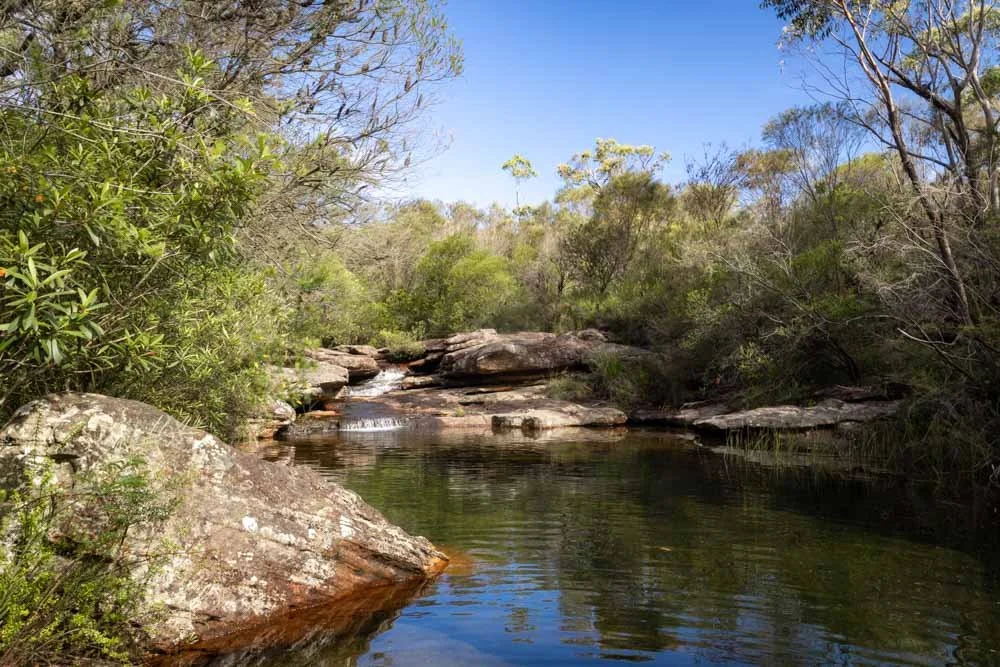
You’ll arrive at the small lagoon 800m into the walk.

Swimming at the small lagoon
I’m calling it the small lagoon, but it’s not really that small at all, just smaller than Engadine Lagoon and I wasn’t able to find out its real name!
It’s a very pretty spot, especially with all the surrounding gum trees which reflect in the water when the air is still.

I was really surprised not to see anyone here, especially as it’s such a short walk and a gorgeous serene swimming spot!
If you fancy taking a dip, it’s best to walk along the rocky river bank on the left for a short distance, so you can enter the lagoon with minimal walking over the slippery rocks inside the water.
At this further point you only need to glide over one rock shelf before it’s deep enough to swim off.
After this, I didn’t encounter any rocks or debris in the lagoon and could have a long leisurely swim in the (relatively) warm water.


When you’re ready to leave this spot you retrace your steps back to the main trail to continue on to Engadine Lagoon.
Continuing on to Engadine Lagoon
After walking for 250m back onto the main trail, you’ll continue briefly downhill before the path flattens. Ignore the next turning you’ll see after 150m and keep straight.
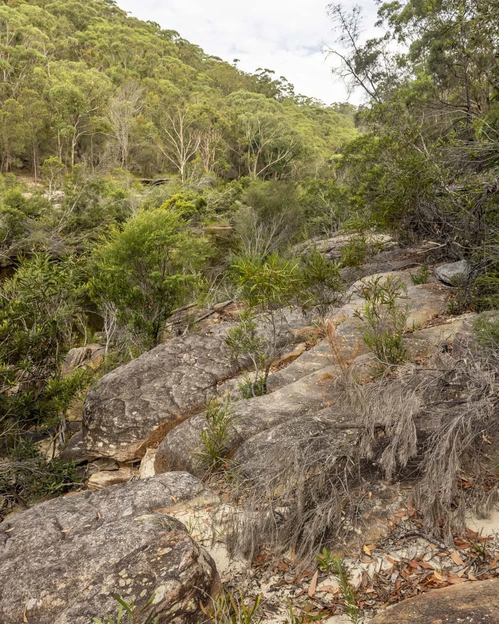
Roughly 200m later, 1.4km into the walk assuming you visited the small lagoon, you’ll begin heading downhill beside some large black boulders.


Roughly 150m later you will come to what feels like a turning circle and take the path at the far side of the circle.
Approximately 50m later the path heads towards the cliff and you need to head left, through the tree fall.

The track heads more steeply downhill and there is some leaf litter amongst the rocks and boulders. It wasn’t as slippery as it looked, but it’s very uneven and probably not so easy after rain.
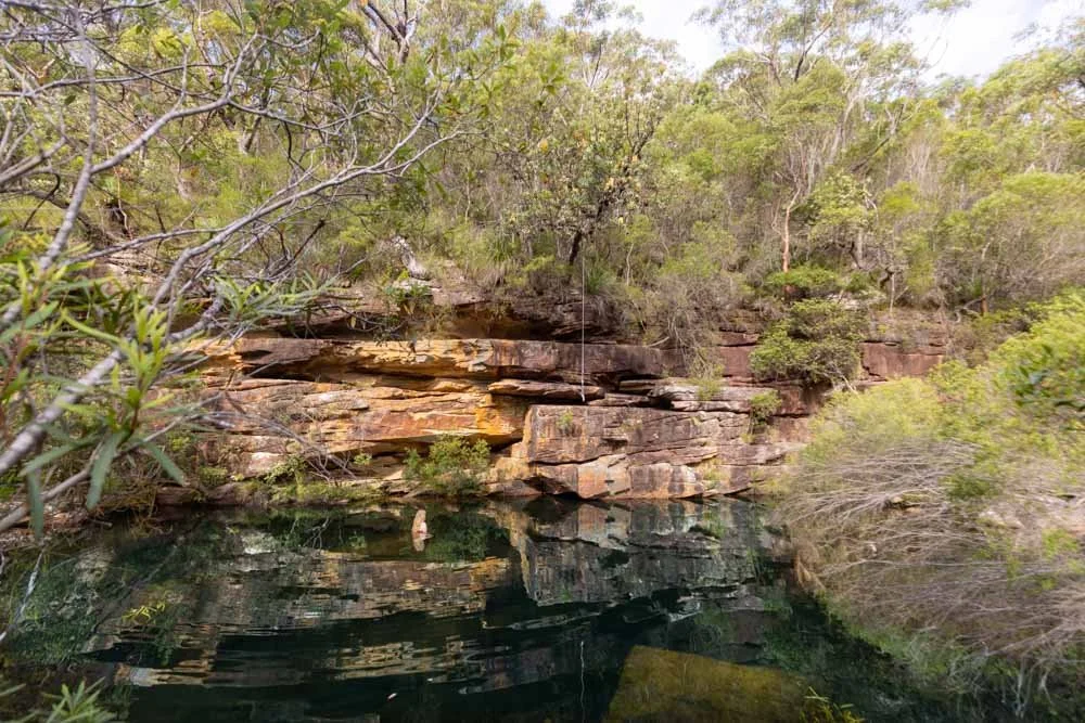
After 100m, or 1.7km into the trail, you will reach the shore of Engadine Lagoon.

I climbed down the rocks and into the water here, but later saw there’s a small beach 50m away to the right, which offers easier access to the water.

Swimming at Engadine Lagoon
Engadine Lagoon is such a great swimming spot, especially if you like ‘proper’ swims. It’s bigger than an olympic pool - easily one of the biggest pools I’ve swum in around Sydney - so you can definitely get your lengths in!
After getting over the initial rocks in the water (which you wouldn’t have to do if you used the beach entry), I didn’t encounter any rocks or debris in the pool.

The whole experience was so serene. The pool is surrounded by dense forested cliffs, as well as an abundance of pretty yellow wildflowers along one side of the river bank, which made the whole scene even more picturesque.
It has a really lovely feel to it and the fact it’s in Sydney and there was nobody else around was pretty incredible.

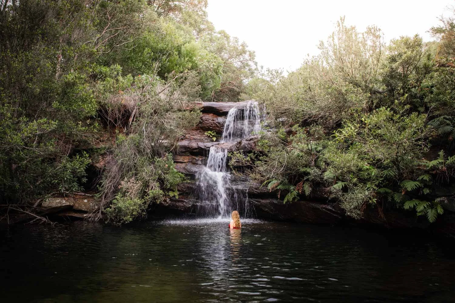
Continuing to The Needles
If you want to complete the circuit track to The Needles then things get a bit rougher. Various flooding events have washed a lot of debris over the easiest route between the two, making it harder than it used to be.
If you want to take an easy route to The Needles, you are better off walking back the way you came, up the main track, but then turning left to take the concrete fire trail downhill when you get back to the first junction you turned off at.
However, if you don’t mind a bit of rough track, then the shorter route is to walk along the shore from the Lagoon to The Needles, which is approximately 750m long (possibly a little less depending on your route as there is no set path).
To do so, continue right from the rocky area beside the water where the main trail ended. After 50m you’ll see the small beach and can continue walking along the water’s edge for a further 50m until you reach a series of rock platforms and a small set of cascades.

The next 300m are pretty easy as you can make your way along the rock platforms beside the water, there are a few rocks to climb here and there, but nothing challenging.
It’s after this point that things get tricker as you’ll meet some significant debris which looked too thick to attempt passing through.
Instead we climbed up the river bank on the right, there’s no path, we just climbed a little until it levelled out and we felt we could traverse easily.

There is a lot of leaf litter around as well as plenty of large webs! You’ll pick your way along as best you can, there is the odd bit of debris even up here, but less so than at creek level.
I wouldn’t say it’s overly slippery when dry, but there were a few loose bits. It’s possible better route finding could make it easier.
After 300m we scrambled back down to the creek and this was a little steep and loose - again you may find an easier route than us, as this was all a bit of a guessing game.

At this point I decided I would be much happier in the water and climbed in before swimming round to The Needles.
Joe continued on the track and came to a little creek crossing and then a ladder which takes you between two boulders up onto a proper trail again.

This was 100m beyond where we scrambled back down to the creek. Funnily enough it was all easy from here, so I didn’t need to get into the water, but I love swimming, so I am always happy in the water anyway!
Just 50m beyond the ladder you’ll come to a paved track and can head over the causeway and round to the small beaches which offer easy access to The Needles swimming hole.
If you’ve walked exactly as we did, to both the small and big lagoon and then round to The Needles, you will have covered about 2.8km.

We’ve covered what to expect from swimming at The Needles in this guide. When you’re ready to leave, to complete the circuit, you head back along the causeway and up the concrete fire trail. It’s a 750m predominantly uphill climb and steep in parts.
Keep them wild
Please remember to take all rubbish with you and keep these places wild and pristine - as with anywhere in the outdoors. It’s important to leave them exactly as you found them so they will remain beautiful for generations to come.
Litter tends to breed litter, so if you do spot any and are able to pick it up and dispose of it outside the area, it will go a long way to keeping the area clean.
There are no facilities at the trailhead for Engadine Lagoon, or anywhere along the walk, please plan accordingly.
Getting to the trailhead for Engadine Lagoon
The trail to Engadine Lagoon begins at the end of Woronora Road in Engadine, which is not part of the national park. There is no car park for this walk, but plenty of room for cars to park at the side of the road. Please don’t park by the gate where the no parking signs are as this area needs to be kept clear. Parking is on a residential street, so please park respectfully.
If you’re coming by public transport you can walk from Engadine Train Station, but this adds on a fairly hefty 2.6km each way.
This post may contain affiliate links, meaning at no additional cost to you, that we will earn a small commission if you click through and decide to make a purchase. This helps towards the costs of running our website. Thanks for your support.