
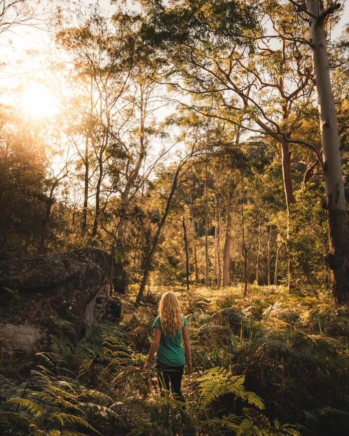
Sydney is a city blessed with natural beauty, but whilst most people think of those coastal walks and harbour walks, we think the bush walks are just as impressive. We’re not talking about a couple of token walks that go through the bush, but fantastic trails that make you feel like you’re out in the wilds, that are right on the city’s doorstep!
As Sydney locals, we’ve done dozens and dozens of bushwalks, and have picked out our favourites. They range from easy strolls to half day adventures, famous trails to hidden gems.
For this article, we’re covering as far as the lower Blue Mountains but no further, if you’re looking for the best walks in the Blue Mountains, you can find them here.
So here are our top Sydney bush walks recommends that you need to check out!
The Best Bush Walks in Sydney
Here are our favourite by category:
Best easy bushwalk - Blue Gum Forest, Hornsby
Best bushwalk for wildlife - Sphinx Memorial to Bobbin Head Loop
Best bushwalk with swimming spot - The Gibberagong Track
Best rainforest walk - The Forest Path, Royal National Park
Best bushwalk with a view - America Bay
-
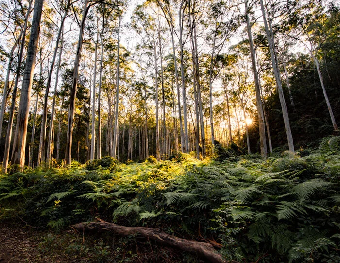
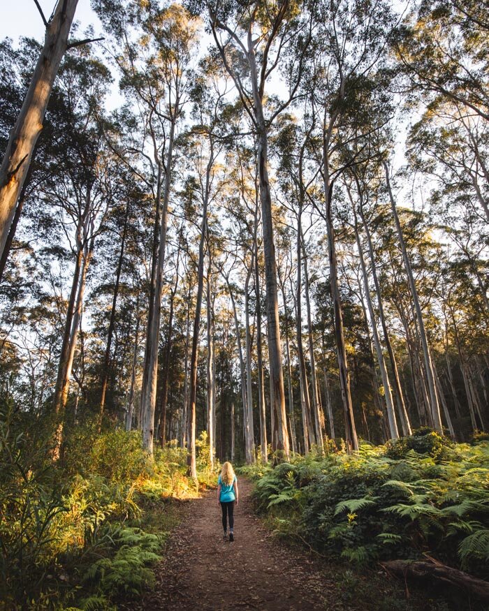
1. Blue Gum Forest, Hornsby
2. The Forest Path, Royal National Park
3. The Resolute Track, Ku-ring-gai Chase National Park
4. The Gibberagong Track, Ku-ring-gai Chase National Park
5. Two Creeks & Little Digger, Garigal National Park
6. Sphinx Memorial to Bobbin Head, Ku-Ring-Gai Chase
7. Stepping Stones to Cascades, Garigal National Park
8. Riverside & Valley Walk, Lane Cove National Park
9. The Couranga Track, Royal National Park
10. Red Hands Cave, Glenbrook
11. The Uloola Track, Royal National Park
12. Jerusalem Bay Track, Ku-ring-gai Chase National Park
13. Park Circuit, Manly Dam
14. Lake Circuit, Parramatta Lake
15. America Bay, Ku-ring-gai Chase National Park
16. Berowra Track, Ku-ring-gai Chase National Park
1. Blue Gum Forest, Hornsby
Difficulty: Easy - moderate
Distance: 4.5km
Elevation: 171m
This gorgeous, short trail has it all: stunning blue gum trees, hillsides covered in ferns, beautiful pools and a long section running beside the river. In fact, it’s one of our favourite walks in Sydney.
It feels wild, but in reality it’s just outside Hornsby town centre! It’s hard to believe a trail that is only 4.5km can be as amazing as this one is.

There’s never a dull moment on this trail and the scenery and terrain is always changing. It’s great for when you’re short on time but want to feel like you’ve got properly out into nature.
There are some uphill climbs and short scrambles which keep it feeling like a mini adventure!

It is usually pretty quiet, which is really quite hard to believe when it’s so close to Hornsby Train Station. This is one Sydney bush walk that needs to be on your list.
You can read more in our detailed guide to the Blue Gum Forest Walk.
Getting to the Blue Gum Forest Walk
The Blue Gum Forest Walk starts at the Rosemead Road Picnic area just outside Hornsby. It’s a 40 minute drive from the CBD or a one hour train ride (take either the North Shore Line or Central Coast & Newcastle Line from Central or Wynyard).
Distance from the CBD: 34km
Accessible by public transport: Yes
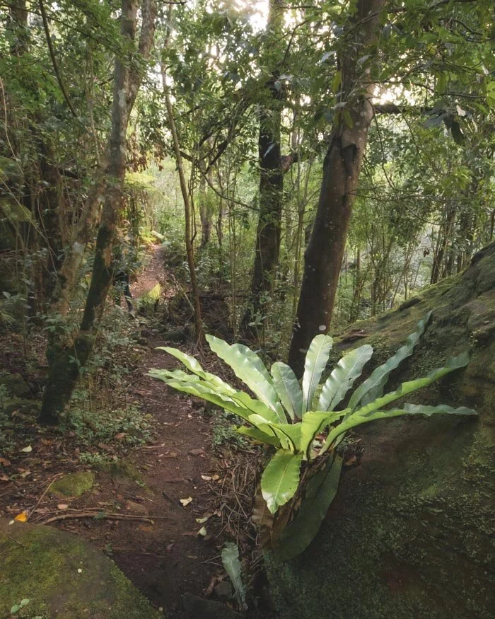
2. The Forest Path, Royal National Park
Difficulty: Easy
Distance: 4.4km
Elevation: 86m
The Forest Path is a hidden gem, and no photos will ever do this walk justice. We absolutely fell in love with it from the moment we set foot on Lady Carrington Drive, and it got even better as we headed into the spectacular rainforest.
I never would have guessed that this short, easy loop would over take lots of the big hitters in Royal National Park in my list of favourite walks.

This trail is all about the jungle vibes, think ginormous plants with leaves so big that they sometimes meet in the middle across the path, hanging vines, towering Cabbage tree palms and so much more.
I lost count of the amount of times I said wow!


It’s best to do this one earlier in the day than we did, as the forest is so dense it blocks out a lot of the light - which makes photography difficult if you’d like to catch some nice pics. Although to be honest, go anytime, just go, it’s really that incredible!
You can read a detailed guide to the Forest Path here.
Getting to the Forest Path
The Forest Path is near to Waterfall in Royal National Park and is a one hour drive south of Sydney. There’s parking at the trailhead, but you will have to pay the park fee ($12 per day).
The only way to get here by public transport is to get a train to Sutherland Train Station, and then hop on the shuttle bus to Lady Carrington Drive (which is the start of the trail). We recommend checking the timetable and schedule by clicking on this link as it changes depending on the season. Tickets on the shuttle cost $9 for a single journey or $15 for the day.
Distance from the CBD: 50km
Accessible by public transport: No, but you can use the park shuttle
3. The Resolute Track, Ku-ring-gai Chase
Difficulty: Moderate
Distance: 5.2km (plus 1.4km return if you also want to visit Mackerel Beach)
Elevation: 295m
We were debating as to whether this counts as a bush walk when it visits three beaches, but as all the walk itself is in the bush we’re going with yes.
This trail is probably the best all rounder in Ku-ring-gai, with the chance to see some wonderfully preserved Aboriginal rock art, an incredible viewpoint, visit three of Sydney’s best secluded beaches and enjoy walking through some pristine bushland.

The walk is generally not too difficult, the climbing is mainly made up of going up and down the cliffside to the three beaches. If you wanted to make it easier you could choose to visit one or two instead - if you only choose one, make it Resolute Beach.
We’ve got all the details on the track including pictures of all three beaches, to help you decide which to visit, in this guide.


Getting to the Resolute Track
The Resolute Track begins at the Resolute Picnic Area in the West Area of Ku-ring-gai National Park. There’s a $12 daily parking fee if you don’t have an NSW parks annual pass.
Unfortunately you can’t access the area by pubic transport.
Distance from the CBD: 43km
Accessible by public transport: No
4. The Gibberagong Track, Ku-ring-gai Chase
Difficulty: Moderate
Distance: 12.8km return (or half if you can do a car shuffle)
Elevation: 304m
The Gibberagong Track is well off the tourist map and even the majority of people who often visit Ku-ring-gai seem to miss it! Don’t let that be you, because this trail is an absolute stunner.
It’s a beautiful creekside walk that even has a couple of epic wild swimming spots (check out the pool below!).

You’ll walk through beautiful bushland where you’re surrounded by the sounds of the birds and trickling water, which makes a blissful escape from the city.
The track undulates quite a lot, has a steep climb at the end and can be rough in patches, so this isn’t a trail for those wanting a really leisurely walk, but if you’re up for putting a little effort in, you will be greatly rewarded.


As soon as you hit the creek the walk feels pretty wild all the way to Bobbin Head, and some of the huge mossy boulder sections even reminded us of Far North Queensland!
You can find out more details in our guide to the Gibberagong Track.
Getting to the Gibberagong Track
The Gibberagong Track starts in North Wahroonga, just outside of the Ku-ring-gai park boundary (so you don’t have to pay the park fee). It is a 40 minute drive from the CBD and you can park for free on the road by the trailhead.
You can get to the trail by public transport, but it is arduous. You will need to get a train from the city to either Turramurra or Hornsby (North Shore Line) and then a bus to Grosvenor Street.
Distance from the CBD: 33km
Accessible by public transport: Just about
5. The Two Creeks & Little Digger Track, Garigal National Park
Difficulty: Moderate
Distance: 7km
Elevation: 217m
The Two Creeks track is one of the closer bush walks to the city on this list and you can create a great loop when you add the often overlooked Little Digger Track. Whether you choose to walk the Two Creeks Track alone or combine it with the Little Digger, it’s one of the best trails in Garigal National Park.
The trail runs along the Middle Harbour Creek, weaving through the bushland with fantastic views of the creek along the way.

It’s a fairly easy and popular walk until you decide to add on the Little Digger which is very rarely used and takes you into a little patch of rainforest. We love this addition because it allows you to create a loop track and the crowds melt away, so it’s just you and the wilds. The Little Digger is a bit rougher but it’s still not difficult.
However you decide to walk the Two Creeks Track you’ll enjoy a gorgeous slice of the Aussie bush.

You can read our detailed guide to both the Two Creeks Track and Little Digger Track which will tell you how to connect up the two trails and what to expect.
Getting to the Two Creeks Track
The best place to start the trail is from the Lindfield Oval on Tryon Road. The trail heads down to the Two Creeks Track and the Little Digger will end pretty close to the oval. There is free street parking and it is only a 20 minute drive from the city.
You can catch a bus from either Milsons Point or from the QVB which will drop you pretty close to the start of the trail too.
Distance from the CBD: 16km
Accessible by public transport: Yes
6. Sphinx Memorial to Bobbin Head, Ku-ring-gai National Park
Difficulty: Moderate
Distance: 10km
Elevation: 267m
The Sphinx Memorial to Bobbin Head Loop Track is one of the best walks in Ku-ring-gai National Park, taking you along Cowan Creek to Empire Marina before looping back to the Sphinx.
Not only will you see beautiful bushland and lots of mangroves, but you have a decent chance of seeing a wild wallaby (we’ve seen them many times on this trail!).
It’s also one of the few tracks like this where you can buy a drink or a snack in the middle of the walk at Empire Marina! It was the first walk I did in Ku-ring-gai and one I return to time and time again.
There are some rocky patches but the terrain is generally pretty good. There is one quite steep climb which comes after the marina, so it doesn’t feel too difficult when fueled by ice cream or coffee!


You can read our detailed guide to the Sphinx Memorial to Bobbin Head loop which tells you exactly what to expect on the trail.
Getting to the Sphinx Memorial to Bobbin Head Loop Trail
The start of the track is a 40 minute drive from the city and you can park just outside the park boundary on Bobbin Head Road in North Turramurra. This has the dual benefit of not having to worry about being locked in when the gate closes at sunset, and avoiding the parking fee!
You can also get here by public transport, by taking the train to North Turramurra and then hopping on the 577 bus. It’s a pretty lengthy journey though!
Distance from the CBD: 29km
Accessible by public transport: You can but it’s not a fun journey
7. Stepping Stone Crossing to Cascades, Garigal National Park
Difficulty: Moderate
Distance: 11.9km return
Elevation: 248m
This trail feels nicely off the beaten track. We hadn’t given Garigal National Park enough credit until recently and it seems we weren’t the only ones! The great thing is that it leaves fantastic tracks like this one completely empty and you really feel like you’re getting away from it all.
Most of the trail runs along Middle Harbour Creek in a wet eucalypt forest, which felt like an ancient rainforest, especially as we were walking on a really misty day! It was the track that got us into exploring so much more of Garigal, which has been an unexpected delight.

The trail finishes at the Cascades, which is one of our favourite places in the park and a great place for a paddle as well as a lovely picnic spot.
The track is slippery and rough in sections, but not too difficult and it adds to the sense of adventure. You can find out more about the trail in our guide to the Stepping Stones Crossing to Cascades Walk.


Getting to the Stepping Stone Crossing to Cascades Walk
The only way to get to this trail is to drive, and it’s a 30 minute journey from the city. You can park at Hunter Street in St Ives and start the trail by following the Pipeline Trail down to the Bungaroo Track.
Distance from the CBD: 18km
Accessible by public transport: No
8. Lane Cove Riverside and Valley Circuit
Difficulty: Moderate
Distance: 11.1km
Elevation: 235m
Both the Riverside Track and the Valley Track are great walks in their own right, but we love combining the two on this fab circuit walk. If you just fancy an easy stroll, pick the Riverside Track only, as the path is flat for the most part and very smooth under foot.

The Riverside Track is gorgeous and you’ll be constantly serenaded by bird song as you make your way along the river, through absolutely beautiful bush land. I love how relaxing it is, as there are barely any stairs or rocks to watch out for, which makes a nice change.


The Valley Walk forms the other half of the loop and takes you along the rougher, but just as beautiful Great North Walk. There are lots of picturesque overhangs and the more rugged terrain gives you that out in the wilds feeling.
Here’s our detailed guide to the full circuit track.
Getting to the Lane Cove Riverside and Valley Circuit
Although you could technically start in many different places along the circuit, we opt for the Koonjeree Picnic Area and start with the Riverside Track. Lane Cove National Park is roughly a 20 minute drive from the city. There is an $8 daily parking fee if you don’t have a parks pass.
Getting to the Riverside Walk by public transport is possible, but requires a train and a bus. You can take the train to Chatswood and then hop on the 259 which stops just outside the entrance of the park.
Distance from the CBD: 13km
Accessible by public transport: Yes but it requires changing
9. Couranga Track, Royal National Park
Difficulty: Moderate
Distance: 10.1km
Elevation: 295m
The Couranga Track will fool you for the first few kilometres, as it seems like a perfectly average bush walk - pretty enough - but nothing to write home about. And then just like that, you take a few steps further and you’re suddenly in a dense and utterly spectacular rainforest.
The change feels almost like magic and completely took me by surprise.
It’s some of the most spectacular rainforest near Sydney and an utter delight to walk through, with towering Cabbage tree palms and hanging vines.
The creek is full of mossy boulders and the whole feel is pure jungle vibes. If you want a longer walk you can even join up with the outstanding Forest Path mentioned at the beginning of this post.


There is one rocky descent and a fair climb along the track but there is also a lot of flat, easy trail too, so it’s not a difficult walk.
We’ve got a full trail guide here.
Getting to the Couranga Track
The Couranga Track begins at Waterfall Train Station, which is around a 45 minute drive from the city. There’s plenty of free parking at the station if you don’t want to catch the train.
To get here by train hop on the Eastern Suburbs & Illawarra line, which takes around an hour from Central Station.
Distance from the CBD: 45km
Accessible by public transport: Yes
10. Red Hands Cave Track, Glenbrook
Difficulty: Moderate
Distance: 7.7km
Elevation: 265m
The Red Hands Cave Track has it all: one of our favourite Aboriginal art sites near Sydney, a truly fabulous wild swimming spot, and a great trail through some gorgeous bushland. Oh, and it never seems to get busy either, which is both a surprise and a bonus!
The walk first passes by Jellybean Pool - a stop on the way back is pretty much mandatory - and then heads into some dense bushland, full of hundreds upon hundreds of ferns. It’s flat and easy for the majority of the way before you begin climbing up to the cave.

The cave is incredibly atmospheric, despite being fenced off, and is full of dozens of red and white stencil hand prints thought to be 1600 years old.
Following the floods of early 2020 small sections of the track have been partly washed away causing you to have a couple of short scrambles (this may be repaired in time) but overall it’s a fairly easy going walk, with one steep climb towards the end.
We have all the finer details in our post on Red Hands Cave.


Getting to the Red Hands Cave Track
The route mentioned above begins at the Jellybean Pool car park which is just under an hours drive from the CBD. There is an $8 daily parking if you don’t have a parks pass, or you can park just before the gate for free. Parking outside the gate adds on 600m to the walk.
You can also get to the trail by taking the train to Glenbrook but you need to add on 3km return to get to and from the station.
Distance from the CBD: 63km
Accessible by public transport: Yes with a short additional walk
11. The Uloola Track - Heathcote to Waterfall, Royal National Park
Difficulty: Moderate
Distance: 11.2km
Elevation: 224m
The Uloola Track is a fabulous station to station bush walk, which takes you to one of our favourite Sydney picnic spots - on top of a waterfall - and to one of the most glorious wild swimming holes in the area too.
The first half of the walk is on fire trail and whilst nice enough, it’s the section from Uloola Falls onwards that makes it really special.

Uloola Falls doesn’t have much water if there hasn’t been recent rain, but we’ve been there even when it’s dry and it’s still an absolutely beautiful spot, with expansive views and lots of little rock pools to paddle in just behind.
The track on to Karloo Pools and then Heathcote Station is rougher, but also narrower and prettier, with lots of gorgeous tropical plants.
There is one fairly lengthy rocky descent and ascent, but lots of the track is also flat so it’s not too difficult.


Here’s our detailed guide to the Uloola Track.
Getting to the Uloola Track
The Uloola Track starts at Waterfall Train Station, roughly 45 minutes from the city, where there is plenty of free parking if you don’t want to take the train. It’s a one way walk, finishing at Heathcote Train Station, so if you do want to drive you’ll need to take the train one stop back to your car.
To get here by train hop on the Eastern Suburbs & Illawarra line, which takes around an hour from Central Station.
Distance from the CBD: 45km
Accessible by public transport: Yes
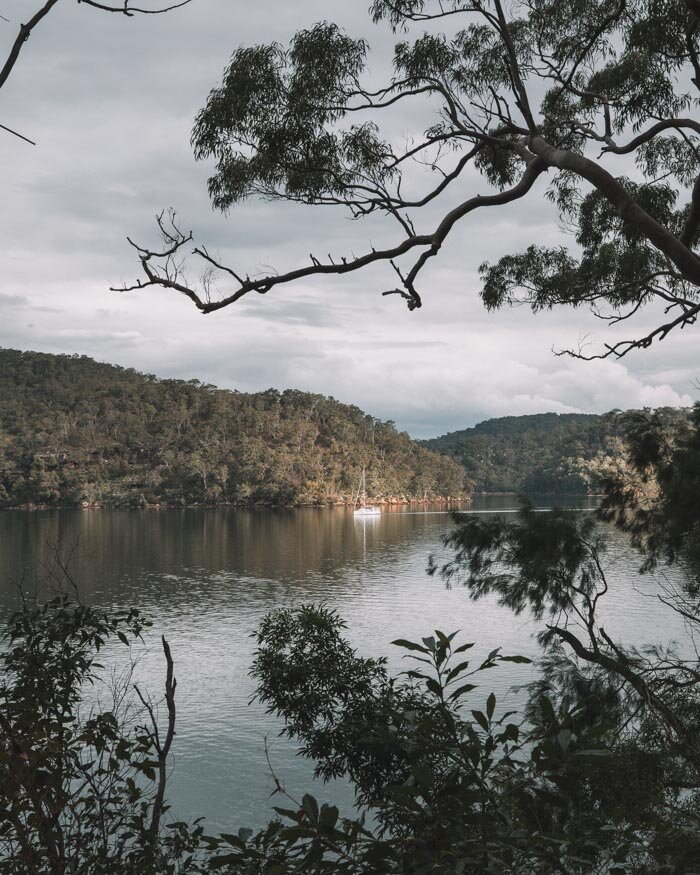
12. The Jerusalem Bay Track, Cowan to Brooklyn, Ku-ring-gai National Park
Difficulty: Moderate - hard
Distance: 14.4km
Elevation: 482m
This is one of the most well known bush walks in Sydney, and even non-hiking friends of mine have done this one. It’s also one of the harder trails on this list.
I always find that interesting because whilst we really like this walk, only half of it is what I’d class as a great bush walk. The other half is on fire trail with limited views.

Having said that, the few views along that part of the walk are rather lovely, and the first half of the track is fantastic.
Not only do you get to visit the gorgeous Jerusalem Bay (which our gloomy photo sadly doesn’t do justice to) where you can go for a mid walk dip, but you’ll walk through some truly stunning bushland, and get a good work out in with a fairly hefty ascent.
The track is pretty rough in places, the roughest of any on this list, but it will still be doable for most people given a bit of time. We recommend walking from Cowan to Brooklyn so you go up the rough terrain and descend on nice, easy fire trail. Your knees will thank you!


Here’s our full guide to the Jerusalem Bay Track.
Getting to the Jerusalem Bay Track
The Jerusalem Bay Track begins at Cowan Train Station, roughly a 45 minute drive from the CBD. There is plenty of free parking at the station. It finishes at Brooklyn (Hawkesbury River) Station where you’ll need to hop on the train back to your car.
You can of course also take the train too, which takes around an hour.
Distance from the CBD: 47km
Accessible by public transport: Yes
13. Park Circuit, Manly Dam
Difficulty: Moderate
Distance: 8.3km (1km more than the sign says)
Elevation: 191m
Manly may be known for its beautiful beaches, but it’s also got a little gem of a bushwalk, which is easily one of our favourite Manly walks.
Manly Dam is known by locals as a good place for a picnic or a leisurely stroll along the lake, but the Park Circuit takes you into the bush, past two waterfalls and even offers the chance of seeing wallabies (we spotted two - something that rarely happens this close to the city!).

There are some really beautiful sections of bushland that you will walk through and it changes from dry and arid at the southern part of the lake, to lush and green along the creek.
When you get to the waters edge there is a huge amount of birdlife, including lots of gorgeous black swans.

The walk isn’t steep, but it does undulate, so we put it in the moderate category. One thing to note is that the trail is not very well signposted so we’ve put a full description in our Manly Dam post.
Getting to Manly Dam
Manly Dam is a 30 minute drive from the CBD and a 10 minute drive from Manly, making it a good accompaniment to a trip to the beach!
Getting to Manly Dam by public transport is a bit trickier as the bus stop is about 2km away from the start of the trail! You can get the B1 Bus to Manly Vale, but then you have to walk a fair amount. It’s not much easier from Manly Wharf either, as you’ll still have to walk about 1.5km from the bus stop to the start of the trail.
Distance from the CBD: 16km
Accessible by public transport: Just about but it’s not an ideal journey
14. The Lake Circuit - Lake Parramatta Reserve
Difficulty: Easy
Distance: 4.2km
Elevation: 93m
Lake Parramatta Reserve is a really lovely piece of bushland and doesn’t seem to get as many visitors as it deserves from those not living in the local area. It’s actually one of our favourite places to watch the sunset in Sydney, if you happen to be able to coincide your walk with golden hour.
There are a few different bush tracks, but by far the best is the Lake Circuit which takes you along all the best trails. Walking around the lake is really relaxing, and you often get some beautiful reflections in the water.

The gum trees, ferns and rocky outcrops definitely make you feel like you’re on a proper bush walk, and it’s hard to believe how close you really are to Parramatta CBD.
The track undulates in places, but doesn’t have any big hills and whilst the path can be rocky, it’s an easy track overall.
You can find out more about this circuit, as well as other things to do at Lake Parramatta Reserve in this post.


Getting to Lake Parramatta Reserve
It takes just over half an hour to drive to Lake Parramatta from the city, there is a smallish car park of 68 spaces on site - despite that we’ve never had trouble parking.
If you’re coming from the city on public transport, you will need to take the train and a bus. From Parramatta train station you can catch the 609 bus. It will drop you off 50m from the reserve.
Distance from the CBD: 33km
Accessible by public transport: Yes
15. America Bay Track, Ku-ring-gai National Park
Difficulty: Easy
Distance: 2km
Elevation: 73m
The America Bay Track is a really short and easy bush walk with a big pay off. It’s a truly sublime picnic spot with a glorious view of the secluded and picturesque America Bay.
For such a short trail it’s hard to believe you get such an outstanding view, as well as the chance to visit some rarely seen Aboriginal engravings, a waterfall and of of course some beautiful bushland.

We always do this trail in the late afternoon when the golden light filtering through the bush is just stunning.
Keep an eye out for Goannas, which are supposed to be common on this trail - although we’ve never actually seem them here ourselves!


We have more details on the America Bay Track in this post.
Getting to the America Bay Track
The America Bay Track is in the West Head area of Ku-ring-gai Chase National Park which takes around an hour to drive to from the city. There isn’t much car parking space but we’ve never had a problem. You’ll need to pay the $12 vehicle entry fee if you don’t have an NSW parks pass.
There is no public transport to this area.
Distance from the CBD: 38km
Accessible by public transport: No
16. The Berowra Track, from Berowra to Mount Ku-ring-gai
Difficulty: Moderate
Distance: 10km
Elevation: 324m
For years we thought we’d done the Berowra Track, as we thought it was the same as the Mount Ku-ring-gai to Berowra walk, which confusingly it isn’t - despite the fact it uses the same two train stations to start and end the track!
Anyway, luckily we ended up doing this trail by accident, and it was an absolute delight! Many of the tracks in the area will see you walk along Cowan Creek at some point, but none spend as much time by the water as this one.

It was really peaceful walking by the picturesque creek, watching the cormorants perch on branches drying their wings, as well as the odd kayaker paddle by. The bush is lovely, and there are even a couple of pockets of what feels like jungle, which is always a treat.
It’s a very pretty walk from start to finish and has one descent and one ascent which are fairly steep but a whole lot of flat track inbetween to relax on.

Here’s our full Berowra Track trail guide.
Getting to the Berowra Track
It takes around 45 minutes to drive to Berowra Train Station from the city, where this track begins. There is plenty of free parking. If you come by car you’ll need to catch the train from Mount Ku-ring-gai Station back to it at the end.
It’s an easy one by public transport taking just over an hour by train from the city.
Distance from the CBD: 42km
Accessible by public transport: Yes
Packing suggestions for Bush Walks in Sydney
Having the right gear can make a huge difference. Here’s what we pack and have relied upon for years:
Sunscreen: Cancer Council Active. With a high SPF, but not the greasy feel of other sunscreens. Makes a big difference when you’re working up a sweat on a sunny day! Check it out on Amazon
Good Rain Jacket: North Face This is an essential item we always pack in our bag! This jacket from North Face is designed to keep you dry but also comfortably warm (many rain jackets will make you feel like you’re in a sauna). Check it out on Amazon
Bushman Spray: Good for keeping off the mozzies, but also handy if there’s leeches after the rain. Check it out on Amazon.
Day Pack: Osprey Talon 22 (we’ve owned this for years). Check on Amazon or direct with Osprey
Hiking Boots: Merrell Moab (for men and women). We’ve both used these for over three years and they just keep going. Check them out on Amazon
Trekking poles: We’ve used Black Diamond for years as they are light, solid and durable. Check them out on Amazon.
Reusable water bottle: To avoid single-use plastic. Check them out on Amazon
Essential Information about Bush Walking in Sydney
A note on weather
We’ve graded these trails on how difficult we feel they are, generally erring on the side of caution and based on having walked over 100 trails around Sydney. If you’re hiking in really hot weather all will feel more difficult than on cooler days.
This post may contain affiliate links, meaning at no additional cost to you, that we will earn a small commission if you click through and decide to make a purchase. This helps towards the costs of running our website. Thanks for your support.
Like it? Pin it!


Follow us on Social Media
What’s your favourite bush walk in Sydney? Any recommends for us? Let us know in the comments below!


